Ras Atiya
| Ras Atiya | |
|---|---|
| Other transcription(s) | |
| • Arabic | خربة رأس عطيّه |
| • Also spelled |
Ras Atiya (official) Khirbat Ras Atiya (unofficial) |
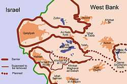 Map of the path of the separation barrier around the Qalqilya and Hableh-Ras Atiya enclaves | |
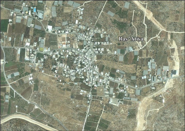
 Ras Atiya Location of Ras Atiya within Palestine | |
| Coordinates: 32°09′31.32″N 34°59′26.89″E / 32.1587000°N 34.9908028°ECoordinates: 32°09′31.32″N 34°59′26.89″E / 32.1587000°N 34.9908028°E | |
| Governorate | Qalqilya |
| Government | |
| • Type | Village council |
| Population (2006) | |
| • Jurisdiction | 1,599 |
| Name meaning | The hill-top of ’Ata[1] |
Ras Atiya (Arabic: خربة رأس عطيّه; Hebrew: ראס עטיה) is a Palestinian town in the Qalqilya Governorate in the Western area of the West Bank, located 27 kilometers South of Tulkarm and 11 kilometers South of Qalqiliya. According to the Palestinian Central Bureau of Statistics, the village had a population of approximately 1,599 inhabitants in 2006.[2]
References
Bibliography
| Wikimedia Commons has media related to Ras Atiya. |
| Wikimedia Commons has media related to Ras at-Tira. |
External link
- Welcome To Khirbat Ras Atiya
- SWP map 14, IAA
- SWP map 14, Wikimedia commons
- Ras 'Atiya (including Ras at Tira & Wadi ar Rasha Localities) (Fact Sheet), ARIJ
- Ras ‘Atiya Village Profile (including Ras at Tira & Wadi ar Rasha Localities), ARIJ
- Ras ‘Atiya, areal photo, ARIJ
| ||||||||||||||||
