Ranong
| Ranong | |
|---|---|
| Town | |
|
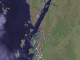
Satellite image around Ranong | |
 Ranong | |
| Coordinates: 9°57′43″N 98°38′20″E / 9.96194°N 98.63889°E | |
| Country |
|
| Provinces | Ranong Province |
| Amphoe | Mueang Ranong District |
| Elevation | 9 m (30 ft) |
| Population (2005) | 16,163 |
| Time zone | UTC+7 (UTC+7) |
Ranong (Thai: ระนอง (Pronunciation)) is a town (thesaban mueang) in southern Thailand, capital of the Ranong Province and the Mueang Ranong district. The town covers completely the area of the tambon Khao Niwet (เขานิเวศน์). As of 2005 it had a population of 16,163.
Geography
Ranong is on the estuary of the Pak Chan (or Kraburi) River, opposite Myanmar's Victoria Point. The Tenasserim Hills rise directly to the east of Ranong, and another small ridge runs along the edge of the estuary to the town's north.
Climate
Ranong has a tropical monsoon climate (Köppen climate classification Am). There is little variation in the temperature throughout the year, although the pre-monsoon months (February to April) are somewhat hotter in the day. However, Ranong's position to the west of the Tenasserim Hills means that the monsoon season's rains are greatly amplified, resulting in torrential rains from May until October, and significant rainfall in the transition months of April and November.
| Climate data for Ranong (1981–2010) | |||||||||||||
|---|---|---|---|---|---|---|---|---|---|---|---|---|---|
| Month | Jan | Feb | Mar | Apr | May | Jun | Jul | Aug | Sep | Oct | Nov | Dec | Year |
| Average high °C (°F) | 32.8 (91) |
34.1 (93.4) |
35.0 (95) |
34.6 (94.3) |
32.4 (90.3) |
31.2 (88.2) |
30.9 (87.6) |
30.5 (86.9) |
30.5 (86.9) |
31.0 (87.8) |
31.4 (88.5) |
31.7 (89.1) |
32.17 (89.92) |
| Average low °C (°F) | 21.9 (71.4) |
22.2 (72) |
23.4 (74.1) |
24.6 (76.3) |
24.7 (76.5) |
24.5 (76.1) |
24.3 (75.7) |
24.2 (75.6) |
23.9 (75) |
23.6 (74.5) |
23.3 (73.9) |
22.4 (72.3) |
23.58 (74.45) |
| Average rainfall mm (inches) | 10.0 (0.394) |
16.0 (0.63) |
65.2 (2.567) |
152.6 (6.008) |
496.6 (19.551) |
649.4 (25.567) |
620.7 (24.437) |
789.1 (31.067) |
646.5 (25.453) |
424.5 (16.713) |
151.3 (5.957) |
45.5 (1.791) |
4,067.4 (160.135) |
| Avg. rainy days (≥ 1 mm) | 4 | 3 | 5 | 12 | 23 | 26 | 27 | 28 | 26 | 23 | 15 | 7 | 199 |
| Average relative humidity (%) | 72 | 70 | 71 | 76 | 83 | 84 | 85 | 86 | 86 | 85 | 80 | 75 | 79.4 |
| Source: Thai Meteorological Department (Normal 1981-2010), (Avg. rainy days 1961-1990) | |||||||||||||
Tourism
Hot Springs and Raksawarin Park
Hot Springs occur naturally. The temperature of the water in the pools remains constant at 65 °C. There is one place where there is not any Sulphur. They provide many services such as taking a bath for health, soaking feet and scalding eggs. Nowadays, this is the most popular tourist place in Ranong.
Rattanarangsarn Place
King Rama V visited Ranong in 1890. So, Phraya Rattanasetthi (Kor Sim Kong) built this hall for the residence of King Rama V. It is located on the hill “Niwest Kiree”. King Rama V named this place “Rattanarangsarn”. This place was made of teakwood and wooden.
Phukhao Ya (Khao Hua Lan) or Grass Hill
Grass Hill is a small mountain which doesn’t have any big trees. In the rainy weather, grasses will go cover the entire hill.
Ngao Mangrove Forest Research Centre
It has been declared “A world biosphere reserve zone” by UNESCO. So, the essential role is to maintain to mangrove’s ecological integrity. Many species of aquatic animals come to the mangrove forest for mating and brooding.
Hat Chan Damri (Chan Damri beach)
This is small beach. It is near Victoria Point of Myanmar. It is located in Paknam Kraburi district.
Hat Praphat
Hat Praphat is large beach that is paralleled by pine trees. The location is at the mouth of a canal Kam Phuan, in Amphoe Kapoe.
Hat Bang Ben
Hat Bang Ben is a long sandy beach. It is shaded by pine trees.
Khlong Nakha Wildlife Reserve
It is a wildlife sanctuary in the southeast of Ranong. It is located within the hills of the Phuket mountain range. This wildlife reserve houses a breathtaking waterfall known as Namtok Phan Met. The people here reserve Thai onion plants. This is the place in Thailand where Thai onion plant was discovered. There are harvested in October.
Tham Pra Kha Yang
Several royal insignias and initial letters of famous visitors are inscribed on the walls. A concrete staircase leads to an upper entrance which is reached via a light squeeze. The location is at Amphoe Kraburi.
Koh Phayam
This island has long white sandy beaches, clear blue sea and coral reefs. The two main bays are Aow Yai (the sunset bay) and Aow Khao Kwai bay. The shape is similar to the kangaroo. (Small roads without cars just motor cycles and bicycle.) The distance from Ranong is 35 kilometer.
Transportation
Phetkasem Road (Thailand Route 4) runs through the city. Ranong Airport is about 24 kilometres (15 mi) south of town.
The Port Authority of Thailand operates the Port of Ranong, which is Thailand's principal Indian Ocean port. In 2008, the Ranong human-trafficking incident resulted in 54 deaths.[1]
References
- ↑ "54 Burmese dead in trafficking horror". Phuket Gazette. April 10, 2008. Retrieved August 3, 2012.
2."http://www.thai-tour.com/thai-tour/south/ranong/main.htm" July 7, 2010. Retrieved November 13, 2014.
External links
 Ranong travel guide from Wikivoyage
Coordinates: 9°57′43″N 98°38′20″E / 9.96194°N 98.63889°E