Ranomafana National Park
| Ranomafana National Park | |
|---|---|
|
IUCN category II (national park) | |
|
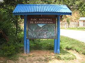
Entrance sign to Ranomafana National Park | |
 Location of Ranomafana National Park in Madagascar | |
| Nearest city | Fianarantsoa |
| Coordinates | 21°13′S 47°25′E / 21.217°S 47.417°ECoordinates: 21°13′S 47°25′E / 21.217°S 47.417°E |
| Area | 416 km² |
| Established | 1991 |
| Governing body | Madagascar National Parks Association |
| Type | Natural |
| Criteria | ix, x |
| Designated | 2007 |
| Reference no. | 1257 |
| State Party | Madagascar |
| Region | List of World Heritage Sites in Africa |
Ranomafana National Park is located in the southeastern part of Madagascar in Haute Matsiatra and Vatovavy-Fitovinany. With more than 41,600 hectares (161 square miles) of tropical rainforest, the park is home to several rare species of flora and fauna such as the lemur. The park was established in 1991 with the purpose of conserving the unique biodiversity of the local ecosystem and reducing the human pressures on the protected area. It is part of the World Heritage Site Rainforests of the Atsinanana.
Geography
The park is situated 65 km North-East of Fianarantsoa and 139 km West of Mananjary in the regions of Haute Matsiatra and Vatovavy-Fitovinany. The National Roads N°45 et N°25 cross the park.[1]
The Park office is located at the entrance in the village of Ambodiamontana, situated at 6,5 km from Ranomafana.
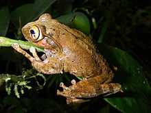
Flora and fauna
The park is an important example of cloud forest, with very high levels of biodiversity.
There are a number of lemur species, including:
- Eastern woolly lemur, Avahi laniger
- Aye-aye, Daubentonia madagascariensis
- Greater dwarf lemur, Cheirogaleus major
- Greater bamboo lemur, Prolemur simus
- Golden bamboo lemur, Hapalemur aureus
- Eastern lesser bamboo lemur, Hapalemur g. griseus
- Red-bellied lemur, Eulemur rubriventer
- Red-fronted brown lemur, Eulemur rufifrons
- Sportive lemur, Lepilemur sp.
- Black and white ruffed lemur, Varecia variegata variegata
- Brown mouse lemur, Microcebus rufus
- Milne-Edwards' sifaka Propithecus diadema edwardsi
Scientific research
The flora and fauna of Ranomafana have been subject to extensive scientific research. Various scientific publications have been published.
Lodging
There is a Lodge and an Ecolodge of a private touristic operator at the entrance of the national park.
See also
External links
| Wikimedia Commons has media related to Ranomafana National Park. |
| Wikivoyage has a travel guide for Ranomafana National Park. |
| ||||||||||||||||
