Rand, Colorado
| Rand, Colorado | |
|---|---|
| Unincorporated community | |
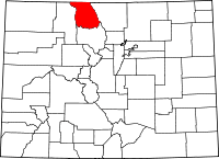
 Rand, Colorado Location within the state of Colorado Location in Jackson County and the state of Colorado | |
| Coordinates: 40°27′15″N 106°10′45″W / 40.45417°N 106.17917°WCoordinates: 40°27′15″N 106°10′45″W / 40.45417°N 106.17917°W | |
| Country |
|
| State |
|
| County | Jackson[1] |
| Established | 1881 |
| Elevation[1] | 8,627 ft (2,630 m) |
| Time zone | MST (UTC-7) |
| • Summer (DST) | MDT (UTC-6) |
| ZIP code[2] | 80473 |
| Area code(s) | 970 |
| GNIS feature ID | 0172876 |
Rand is an unincorporated community and a U.S. Post Office established in 1881 in Jackson County, Colorado. It is a ranching community at the southern end of North Park south of Walden consisting of several homes and businesses, a post office, and ranching facilities. Rand is near the junction of State Highway 125 and Jackson County Road 27 along Indian Creek, at an elevation of 8627 feet (2630 meters). The post office was established in 1883 and the first postmaster was Jack Rand. The Rand post office has the ZIP code 80473.[2]
Geography
Rand is located at 40°27′15″N 106°10′45″W / 40.45417°N 106.17917°W (40.454262,-106.179256).
See also
References
- ↑ 1.0 1.1 "US Board on Geographic Names". United States Geological Survey. 2007-10-25. Retrieved 2008-01-31.
- ↑ 2.0 2.1 "ZIP Code Lookup" (JavaScript/HTML). United States Postal Service. January 2, 2007. Retrieved January 2, 2007.
| |||||||||||||||||