Rampton, Nottinghamshire
| Rampton | |
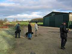 Farm buildings, Rampton |
|
 Rampton |
|
| Population | 1,269 |
|---|---|
| OS grid reference | SK798785 |
| Civil parish | Rampton |
| District | Bassetlaw |
| Shire county | Nottinghamshire |
| Region | East Midlands |
| Country | England |
| Sovereign state | United Kingdom |
| EU Parliament | East Midlands |
|
|
Coordinates: 53°17′51″N 0°48′15″W / 53.29746°N 0.80414°W
Rampton is a village and civil parish in Nottinghamshire, England. At the time of the 2001 census it had a population of 1,269.[1] Its name came from Anglo-Saxon Ramm-tūn = "ram farmstead". It is located in the Trent valley north of Nottingham, in the Bassetlaw district 8 miles east of Retford. The village is overshadowed by the chimney and cooling towers of Cottam Power Station. At the heart of the village is the Eyre Arms pub.
The parish church of All Saints is Early English in architectural style. Between the church and Hill's Farm is an early Tudor brick gateway with terracotta panels belonging to the former Manor House. The Manor House was demolished c. 1850.[2]
Rampton Secure Hospital is 2.3 km = 1.4 miles WSW of Rampton village.
References
- ↑ "Area:Rampton CP (Parish)"
- ↑ Pevsner, Nikolaus. 1979. The Buildings of England:Nottinghamshire.Harmondsworth, Middx. Penguin.
External links
![]() Media related to Rampton, Nottinghamshire at Wikimedia Commons
Media related to Rampton, Nottinghamshire at Wikimedia Commons
| ||||||||||||||||||