Ramjibanpur
| Bagchari | |
|---|---|
| Town | |
 Bagchari Location in West Bengal, India | |
| Coordinates: 22°50′N 87°37′E / 22.83°N 87.62°ECoordinates: 22°50′N 87°37′E / 22.83°N 87.62°E | |
| Country |
|
| State | West Bengal |
| District | Paschim Medinipur |
| Elevation | 11 m (36 ft) |
| Population (2001) | |
| • Total | 17,363 |
| Languages | |
| • Official | Bengali, English |
| Time zone | IST (UTC+5:30) |
| Lok Sabha constituency | Arambagh |
| Vidhan Sabha constituency | Chandrakona |
| Website |
paschimmedinipur |
Ramjibanpur is a town and a municipality in Paschim Medinipur district in the Indian state of West Bengal.
Geography
Ramjibanpur is located at 22°50′N 87°37′E / 22.83°N 87.62°E.[1] It has an average elevation of 11 metres (36 feet).
Demographics
As of 2001 India census,[2] Ramjibanpur had a population of 17,363. Males constitute 51% of the population and females 49%. Ramjibanpur has an average literacy rate of 72%, higher than the national average of 59.5%: male literacy is 78%, and female literacy is 66%. In Ramjibanpur, 14% of the population is under 6 years of age.
Ramjibanpur City Images
-

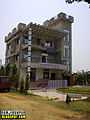
Ramjibanpur Babulal Institution, Ramjibanpur
-
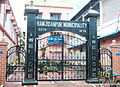
Ramjibanpur Municipality, Ramjibanpur, West Midnapur
-
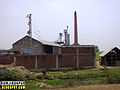
Ramjibanpur Rice Mill
-

Ramjibanpur bypas road
-

Ramjibanpur Green city
-

Ramjibanpur Local Transport
-
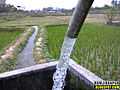
Ramjibanpur Water Source
-

Ramjibanpur bypas road
-

Ramjibanpur Idgah near Kalapat
-

Ramjibanpur Green City
-
Ramjibanpur Education Society School
References
- ↑ Falling Rain Genomics, Inc - Ramjibanpur
- ↑ "Census of India 2001: Data from the 2001 Census, including cities, villages and towns (Provisional)". Census Commission of India. Archived from the original on 2004-06-16. Retrieved 2008-11-01.
| ||||||||||||||||||||||||||||||||
| ||||||||||||||||||||||||||||||||||||||||||||||||||||||||||||||||||||||||