Ramelton
| Ramelton Ráth Mealtain | |
|---|---|
| Town | |
|
The bridge over River Lennon in Ramelton. | |
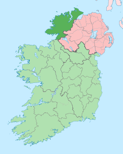
 Ramelton Location in Ireland | |
| Coordinates: 55°02′08″N 7°38′44″W / 55.03562°N 7.64555°WCoordinates: 55°02′08″N 7°38′44″W / 55.03562°N 7.64555°W | |
| Country | Ireland |
| Province | Ulster |
| County | County Donegal |
| Population (2011) | |
| • Urban | 1,212 |
| Time zone | WET (UTC+0) |
| • Summer (DST) | IST (WEST) (UTC-1) |
| Irish Grid Reference | B847228 |

Ramelton (Irish: Ráth Mealtain) is a town in County Donegal, Ireland. Its population is 1,212 (2011).
Ramelton is situated at the mouth of the River Lennon, 11 km north of Letterkenny and 4 km east of Milford, on the western shores of Lough Swilly. The town is named from Ráth Mealtain, (Irish for "the fort of Mealtan"), an early Gaelic chieftain. The fort is said to lie under the ruins of a medieval castle of the O'Donnells, the ruling family of West Donegal before their exile to mainland Europe in 1607.
Ramelton was settled by English and Scots planters during the Ulster Plantation of the 17th century and is the site of the oldest Presbyterian church in Ireland.
Ramelton also has a Church of Ireland Church of St.Paul, Parish of Tullyaughnish.
The town was the setting for the 1995 television serial The Hanging Gale, which told of the potato Famine of the 19th century. The town hosts the Lennon Festival, a village fair, since 1970. Ramelton is a Fáilte Ireland designated Heritage Town.
Notable people
- Roy Greenslade[1]
- Dave Gallaher, All Blacks rugby captain, author and WW1 hero
- Arthur Gwynn, cricket and rugby union player
- Lucius Gwynn, cricket and rugby union player
- John Tudor Gwynn, cricket player
- Robert Gwynn, cricket player
- President James Buchanan
- Nurse Catherine Black MBE, RCC, SRN
- Conrad Logan, professional footballer
- Samuel Gamble Bayne, businessman, international traveller, philanthropist, international cricketer, artist, cartoonist and author
- Charles Knox, hatter to the famous
- Francis Makemie, clergyman, the founder of Presbyterianism in the United States
- Robert Bonner, newspaper magnate
- William McAdoo (New Jersey)
- Basil McCrea, MLA, Leader of NI21 in the Northern Ireland Assembly at Stormont; formerly a prominent member of the UUP
- Walter Patterson, first British Governor of Prince Edward Island
- William C. Campbell (Sc.D.)
See also
- List of towns and villages in the Republic of Ireland
- List of towns in Northern Ireland
References
- ↑ "The Irish still love their newspapers". The Guardian (Guardian Media Group). 14 August 2010. Retrieved 14 August 2010.
The Irish love reading newspapers, whether they are national or local. It's a joy to see the papers piled high at my local store in the Donegal town of Ramelton in the morning and note their disappearance by the evening.
External links
| Wikimedia Commons has media related to Ramelton. |
| ||||||||||||||||||||||||||||||||||