Ramburelles
| Ramburelles | |
|---|---|
|
School | |
 Ramburelles | |
|
Location within Picardy region  Ramburelles | |
| Coordinates: 49°58′05″N 1°42′38″E / 49.9681°N 1.7106°ECoordinates: 49°58′05″N 1°42′38″E / 49.9681°N 1.7106°E | |
| Country | France |
| Region | Picardy |
| Department | Somme |
| Arrondissement | Abbeville |
| Canton | Gamaches |
| Government | |
| • Mayor (2001–2008) | Michel Dubus |
| Area1 | 4.59 km2 (1.77 sq mi) |
| Population (2006)2 | 244 |
| • Density | 53/km2 (140/sq mi) |
| INSEE/Postal code | 80662 / 80140 |
| Elevation |
104–133 m (341–436 ft) (avg. 130 m or 430 ft) |
|
1 French Land Register data, which excludes lakes, ponds, glaciers > 1 km² (0.386 sq mi or 247 acres) and river estuaries. 2 Population without double counting: residents of multiple communes (e.g., students and military personnel) only counted once. | |
.jpg)
Ramburelles is a commune in the Somme department in Picardie in northern France.
Geography
Ramburelles is situated on the D263 road, some 10 miles (16 km) southwest of Abbeville.
Population
| 1926 | 1931 | 1936 | 1962 | 1968 | 1975 | 1982 | 1990 | 1999 | 2006 |
|---|---|---|---|---|---|---|---|---|---|
| 222 | 214 | 221 | 200 | 213 | 228 | 211 | 231 | 210 | 244 |
| Starting in 196: Population without duplicates | |||||||||
History
- In 1218, Bishop Evrard puts the parish under the deanship of Oisemont.
- In the 14th century, it came under the provost of the Vimeu.
- Before leaving, in 1944, the Germans burnt down the school and the chateau.
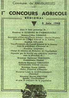
- In 1922, the local council agreed to the installation of a telephone kiosk.[1] It wasn’t working until 1924.
Event from after World War I
.
- In 1922 and 1923, electrification came to the village. Public buildings waited until 1929.
- In 1932, the local council agreed to provide a fresh water supply to the commune. It wasn’t completed until 1953.
- in 1948, the roads of the commune were covered in tarmac for the first time.
Heraldry
_Nord-France.svg.png) |
The arms of Ramburelles are blazoned : Azure, an inescutcheon argent. (Gouzeaucourt, Saint-Jean-de-Vals, Ramburelles, Saint-Menge, Colombey-les-Belles and Ostreville use the same arms.) |
Places of interest
- The traces of a castle can be seen in pastureland near the village.
- The sixteenth century church, completed in 1536
- The château
- The war memorial, from 1922
- Ancient wells, used until clean water was supplied to the village.
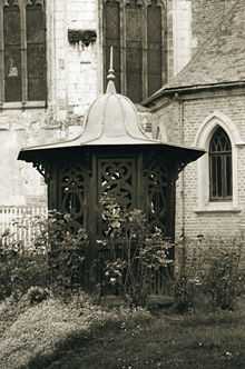
- The school. It was planned in 1878 and built soon after.
Personalities
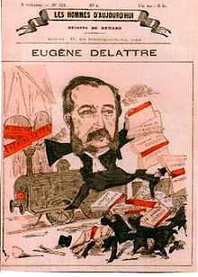
Front page of Les hommes d'aujourd'hui in 1870
- Paul Eugène Delattre (1830–1898). Lawyer, politician, writer
See also
References
- ↑ Travail collectif de la Coopérative scolaire de Ramburelles
External links
| Wikimedia Commons has media related to Ramburelles. |
- Ramburelles on the Quid website (French)