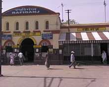
Rafiganj
| Rafiganj | |
|---|---|
| city | |
 Rafiganj Location in Bihar, India | |
| Coordinates: 24°49′N 84°39′E / 24.82°N 84.65°ECoordinates: 24°49′N 84°39′E / 24.82°N 84.65°E | |
| Country |
|
| State | Bihar |
| District | Aurangabad |
| Named for | MD Rafi |
| Government | |
| • Body | Mla |
| Elevation | 89 m (292 ft) |
| Population (2001) | |
| • Total | 23,889 |
| Languages | |
| • Official | Magahi, Hindi |
| Time zone | IST (UTC+5:30) |
| <!-- PIN --> | 824125 |
Rafiganj is a city and a notified area in Aurangabad district in the Indian state of Bihar.
Geography
Rafiganj is located at 24°49′N 84°39′E / 24.82°N 84.65°E.<ref>Falling Rain Genomics, Inc - Rafiganj</ref> It has an average elevation of 89 metres (291 feet).
Demographics
As of 2001 India census,<ref>"Census of India 2011: Data from the 2011 Census, including cities, villages and towns (Provisional)". Census Commission of India. Archived from the original on 2004-06-16. Retrieved 2008-11-01.</ref> Rafiganj had a population of 55,389. Males constitute 52% of the population and females 48%. Rafiganj has an average literacy rate of 79%, more than the nationalh average of 59.5%: male literacy is 55%, and female literacy is 41%. In Rafiganj, 29% of the population is under 6 years of age.
Educational institutions
- Govt Urdu Middle School Quazichak (Well Facilitate Urdu Middle school)
- British Academy (well renowned private school in Rafiganj)
- R.B.R High school
- Bosco international school
- Dr.V.K.Singh College Rafiganj
- High School Karma
- B.L. Indo Anglian Public School, Aurangabad, on NH-98 10 km from Rafiganj
- Sarswati shishu manadir
- Brite Life Public School,(Affiliated from Delhi )
- MOTHER TERESA ACADEMY[M.T.A] Managed by M.t.a educational Trust W.B.
- All Rounder Communication Centre (ARCC) An ISO 9001 - 2008 Certified Organization (A unit of Shams Foundation)
Health
- A K Keshari clinic
- Government hospital
- PHC RAFIGANJ
References
Tourism
In Rafiganj "Jama Masjid Quazichak" is a mosque which is known as one of the biggest mosques in Bihar. It was constructed in the 18th century in front of the Mosque Govt Urdu Middle school which was established in the British Era. In Rafiganj 'PARCHAR PAHAR' a mountain in which a the temple of 'God Parashnath' is founded and a 30 feet painting of 'Lord Mahavira' is built. It is a very beautiful place for tourism.
See also
Wikipedia:WikiProject Indian cities www.fb.com/rafiganjbihar
| ||||||||||||||||||||||||||||||