Rafi, Nigeria
| Rafi | |
|---|---|
| LGA | |
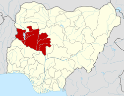
 Rafi Location in Nigeria | |
| Coordinates: 10°11′04″N 6°15′12″E / 10.18444°N 6.25333°ECoordinates: 10°11′04″N 6°15′12″E / 10.18444°N 6.25333°E | |
| Country |
|
| State | Niger State |
| Area | |
| • Total | 3,680 km2 (1,420 sq mi) |
| Population (2006 census) | |
| • Total | 181,929 |
| Time zone | WAT (UTC+1) |
| 3-digit postal code prefix | 922 |
| ISO 3166 code | NG.NI.RA |
Rafi is a Local Government Area in Niger State, Nigeria. Its headquarters are in the town of Kagara on the A125 highway. The southern border of the area is the Kaduna River.
It has an area of 3,680 km² and a population of 181,929 at the 2006 census.
The postal code of the area is 922.[1]
References
- ↑ "Post Offices- with map of LGA". NIPOST. Retrieved 2009-10-20.
| |||||||||||||