Radgonica
| Radgonica | |
|---|---|
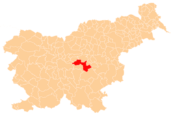
_location_map.svg.png) Radgonica Location in Slovenia | |
| Coordinates: 46°2′44.48″N 15°3′29.78″E / 46.0456889°N 15.0582722°ECoordinates: 46°2′44.48″N 15°3′29.78″E / 46.0456889°N 15.0582722°E | |
| Country |
|
| Traditional region | Lower Carniola |
| Statistical region | Central Slovenia |
| Municipality | Litija |
| Area | |
| • Total | 2.12 km2 (0.82 sq mi) |
| Elevation | 755.5 m (2,478.7 ft) |
| Population (2002) | |
| • Total | 11 |
| [1] | |
Radgonica is a small settlement east of Dole in the Municipality of Litija in central Slovenia. Traditionally the area was part of Lower Carniola and is now included with the rest of the municipality in the Central Slovenia statistical region.[2]