Rabud
| Rabud | |
|---|---|
| Other transcription(s) | |
| • Arabic | ﺩﺍﺒﺭ |
| • Also spelled | Khirbet Rabud (official) |
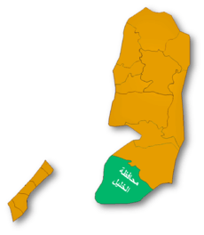
 Rabud Location of Rabud within Palestine | |
| Coordinates: 31°26′0″N 35°1′0″E / 31.43333°N 35.01667°ECoordinates: 31°26′0″N 35°1′0″E / 31.43333°N 35.01667°E | |
| Governorate | Hebron |
| Government | |
| • Type | Village council (from 1993) |
| • Head of Municipality | Muhammad Huraibat[1] |
| Area | |
| • Jurisdiction | 2,200 dunams (2.2 km2 or 0.8 sq mi) |
| Population (2007) | |
| • Jurisdiction | 2,262 |
Rabud (Arabic: ﺩﺍﺒﺭ, also spelled Khirbet Rabud) is a Palestinian village in the southern West Bank, part of the Hebron Governorate, located 13 kilometers southwest of Hebron and about 5 km northwest of as-Samu. Rabud had a population of 2,262 in the 2007 census by the Palestinian Central Bureau of Statistics (PCBS).[2] The principal families are the Huraibat, Quteinah, al-Uqela and Shanan.[3]
According to research by the Applied Research Institute-Jerusalem, Rabud's history dates back to the Canaanite period in Palestine, but that the modern inhabitants of the village migrated from the Arabian Peninsula. A village council was established by the Palestinian National Authority in 1993 to administer Rabud's civil affairs and provide limited municipal services.[3] There is currently one mosque, Salah ad-Din Mosque, which serves the village.
References
- ↑ Rabud Profile. Jerusalem Media and Communications Center (JMCC).
- ↑ 2007 PCBS Census. Palestinian Central Bureau of Statistics (PCBS).
- ↑ 3.0 3.1 Rabud Village Profile. Applied Research Institute-Jerusalem (ARIJ). 2009.
| ||||||||||||||||||||