ROC Post Portland Bill
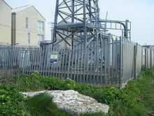
ROC Post Portland Bill was a Royal Observer Corps Monitoring Post on the Isle of Portland, Dorset, England. The post was in use from 1960 until 1991, and has since been demolished. Although named after Portland's southerly promontory Portland Bill, the site was really situated close to the cliff edge of West Weares, near the housing estates of Weston village.[1] The site's location was within a square compound within the south-west corner of a playground, at the end of Grangecroft Road. It lay on the north side of a public footpath.[2] Nearby is the Victorian fort Blacknor Fort.
History
The ROC post at Portland was just one of over 1500 underground structures built all over the United Kingdom, constructed as a result of the Corps' nuclear reporting role and operated by volunteers during the Cold War between 1955 and 1991. They were designed to house three members of the Royal Observer Corps, whose job it would be to use supplied equipment to gauge the bomb power and ground zero of a nuclear blast and report back to a group H.Q. Like most, Portland's ROC post was built to a standard design consisting of a 14-foot-deep access shaft, a toilet/store and a monitoring room. The post was re-sited from Stopes Power, and opened on 1 August 1960. Although a third of posts across the UK were closed in 1968 during a reorganisation and major contraction of the ROC, Portland's post remained operational until 1 September 1991.[3][4]
Nick Catford of the Subterranea Britannica visited the site in July 1997 and again in September 2004. The reports of the post revealed that all surface features remained intact, although the post was in slight depression, where since 2003 this depression was filled up to the level of the surrounding land. The top part of the access shaft had been reconstructed and a new larger Torlift hatch was fitted. During the 1997 inspection the hatch had been welded shut, however by the 2004 visit the welds were ground off, allowing access to open the hatch with a Torlift key. However the security plug had become badly worn-out and therefore difficult to extract. The interior of the post, within the monitoring room continued to hold a table, shelf, cupboard, BPI mount, FSM pipe blanking plate, BT junction boxes and wiring, 2 waste bins, small splint, candle holder, two lights, cluster map and two posters. Additionally there was a shelf by door, and a small rack of shelves on the wall above the cupboard. Within the toilet/store room two shelves remained. By 2002 the compound fencing had been removed.[2][5]
In 2007 it was reported that the post was soon to have the air vents and entrance way cut down, in order for the site to be used as an overflow water storage tank. By this point the post had been cleared up and leveled for drainage work. The landowner spent £800 on a confined space entry team to investigate what it was. Although unclear as to whether the site was successfully transformed into a tank, by 2008 any signs of the post had been demolished, where disturbed ground marked the spot where the post once was.[2]
Satellite Post
From 1940 onwards, especially from 1942, it was decided to establish approximately 150 'satellite' posts along a stretch of 30 miles wide along the south coast of the UK and on the east coast as far north as Dundee, as well as on the coast of Lancashire and Cheshire, in order to combat the threat of the low level intruder and to improve low level coverage in the ROC reporting chain. A total of 27 ROC satellite posts were set up, each manned by a single observer. Every satellite post would be connected via land-line telephone to its parent ROC post and reported all low flying aircraft movements to that post. Dorset in particular had six satellites with two being ROC and four being coastguard satellites. The site of the Portland Bill ROC Post was an example, with a satellite at Stope Tower. Satellite posts were manned from 1942 to 1943 but as enemy activity decreased into 1944 and 1945, manning at satellites tapered off. Although some satellite posts were made of block or brick, almost no photographs survive showing what one looked like.[6]
References
- ↑ "Weston Estate, Portland". Geoffkirby.co.uk. Retrieved 2014-03-23.
- ↑ 2.0 2.1 2.2 "Portland Bill Dorset". Subbrit.org.uk. Retrieved 2014-02-07.
- ↑ "Underground Posts - ROC". Roc-heritage.co.uk. Retrieved 2014-02-07.
- ↑ "Posts Map - ROC". Roc-heritage.co.uk. Retrieved 2014-02-07.
- ↑ http://www.pastscape.org.uk/hob.aspx?hob_id=1413186&sort=2&type=&rational=a&class1=None&period=None&county=93347&district=93625&parish=93626&place=&recordsperpage=10&source=text&rtype=&rnumber=&p=2&move=n&nor=294&recfc=0
- ↑ "Satellite Posts - ROC". Roc-heritage.co.uk. 1942-09-22. Retrieved 2014-02-07.
Coordinates: 50°32′23″N 2°27′06″W / 50.5396°N 2.4518°W
| ||||||||||||||||||||||||||||||||||||||||||||||||||||||||||||||||||