R102 road (South Africa)

The R102 is a Regional Route in South Africa. It is the route designation for all old sections of the N2, thus it is a discontinuous road that resumes in areas where a new N2 has been constructed.
Route
Western Cape and Eastern Cape
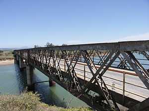
In the Cape Town area, the R102 starts in the Central Business District, through Bellville, then onwards to Somerset West where it merges with the existing N2. At Mossel Bay it divides to the east again, passing through all the towns between there and George. Near Nature's Valley east of Plettenberg Bay it once again splits off, traversing the various Tsitsikamma gorges such as the Bloukrans Pass and then rejoining the N2 east of the Bloukrans Bridge. Farther east, in the Eastern Cape, it passes through the towns of Humansdorp and Jeffreys Bay before crossing the Gamtoos River and the Van Stadens River on its way to Port Elizabeth, before merging with the N2 at Coega.
KwaZulu-Natal
The R102 separates from the N2 in Port Shepstone and passes through the South Coast towns of Anerley, Umzumbe and Hibberdene, before heading inland and passing through the Mnamfu area. It then turns back towards the coast and passes through Pennington, Park Rynie, Scottburgh and Umkomaas before entering the greater Durban area at Kingsburgh. The route then passes through Amanzimtoti, then passes through the industrial suburbs of Prospecton, Mobeni and Congella before entering Durban's Central Business District from the south.
North of Durban, the route bypasses KwaMashu and Phoenix, then passes through Verulam and Tongaat before heading towards Stanger (now KwaDukuza). After Stanger, the route heads through Darnall, Mandini and Gingindlovu, passes close to Mtunzini, before heading to Empangeni. A few kilometres north of Empangeni, the route merges with the N2.
References
- ↑ Sellick, W.S.J. (1904). Uitenhage, past and present : souvenir of the Centenary, 1804-1904. pp. 186, 187.
External links
| Wikimedia Commons has media related to R102 road (South Africa). |
| ||||||||||||||||
