Qiruqucha
| Qiruqucha | |
|---|---|
 | |
| Location | Ancash Region |
| Coordinates | 9°42′58″S 77°19′27″W / 9.71611°S 77.32417°WCoordinates: 9°42′58″S 77°19′27″W / 9.71611°S 77.32417°W |
| Basin countries | Peru |
| Max. length | 2.43 km (1.51 mi) |
| Max. width | 0.87 km (0.54 mi) |
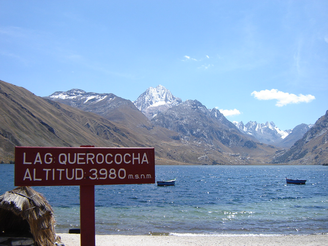
| Surface elevation | 3,980 m (13,060 ft)[1] |
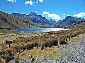
Qiruqucha (Quechua qiru ceremonial drinking vessel, qucha lake[2][3] "qiru lake", hispanicized spelling Querococha) or Q'iruqucha (Quechua q'iru wood, "wood lake") is a lake in Peru located in the Ancash Region, Recuay Province, in the districts Ticapampa and Catac.[4] The lake is situated at a height of 3,980 metres (13,058 ft), about 2.43 km long and 0.87 km at its widest point. Qiruqucha lies on the western side of the Cordillera Blanca, southwest of Yanamaray and Pukarahu, northwest of Mururahu and Qishqi and east of Recuay.
See also
- Qishqiqucha
- List of lakes in Peru
References
- ↑ static.flickr.com
- ↑ Leonel Alexander Menacho López, Yachakuqkunapa Shimi Qullqa, Anqash Qhichwa Shimichaw (Ministerio de Educación), Wordbook Ancash Quechua-Spanish
- ↑ Teofilo Laime Ajacopa, Diccionario Bilingüe Iskay simipi yuyayk'ancha, La Paz, 2007 (Quechua-Spanish dictionary)
- ↑ escale.minedu.gob.pe - UGEL map of the Recuay Province (Ancash Region)
- INEI, Compendio Estadistica 2007, page 26