Qhuyu Parwayuni
| Qhuyu Parwayuni | |
|---|---|
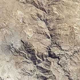 Satellite image of the Ubinas volcano (on the left) and Qhuyu Parwayuni northwest of it | |
| Elevation | 4,647 m (15,246 ft)[1] |
| Location | |
 Qhuyu Parwayuni Peru | |
| Location | Peru, Moquegua Region |
| Range | Andes |
| Coordinates | 16°17′31″S 70°54′17″W / 16.29194°S 70.90472°WCoordinates: 16°17′31″S 70°54′17″W / 16.29194°S 70.90472°W |
Qhuyu Parwayuni (Aymara qhuya, qhuyu mine, parwayu blossom of cereals,[2] -ni a suffix to indicate ownership, hispanicized spelling Ccuyo Parhuayuni) is a 4,647-metre (15,246 ft) high mountain in the Andes of Peru. It is located in the Moquegua Region, General Sánchez Cerro Province, Ubinas District. Qhuyu Parwayuni is situated north of the active Ubinas volcano and south of Parwayuni.[1][3]
References
- ↑ 1.0 1.1 Peru 1:100,000, Lloque 2738, Map prepared and published by the Defense Mapping Agency, Hydrographic/Topographic Center, Bethesda, MD
- ↑ "Diccionario Bilingüe, Castellano - Aymara, 2002". Félix Layme Pairumani. Retrieved December 17, 2014. (see: Flor)
- ↑ escale.minedu.gob.pe - UGEL map of the General Sánchez Cerro Province (Arequipa Region)