Qara Oasis
Coordinates: 29°37′17.68″N 26°29′50.94″E / 29.6215778°N 26.4974833°E / 29.6215778; 26.4974833

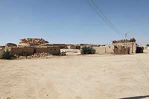
Qara village

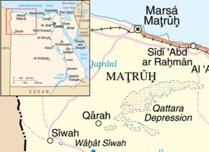
Map of Qara
Qara or Cara or Qārat Umm eṣ-Ṣugheir or Qarat Umm el-Sugheir is one of the inhabited oases of Egypt, with a population of 363 Berbers (census 2006-11-11),[1] though of a darker complexion than the inhabitants of Siwa Oasis. This oasis is often disregarded when it comes to counting the number of Egyptian oases as it is very small compared to the others. In local folklore if a newborn arrives, an elder will die shortly after, thus keeping the population constant. It lies at the northwest edge of the Qattara Depression, 75 km northeast of Siwa Oasis, and belongs to Siwa District within Matrouh Governorate and is connected to the Matruh-Siwa road by an asphalted access route. Originally the inhabitants lived atop a neighbouring mountain which acted as a natural fortress, but today they live in simple houses beneath. Electricity for street-lighting and houses is provided by small individual solar cells.
Sources


