Qaqapampa
| Qaqapampa | |
|---|---|
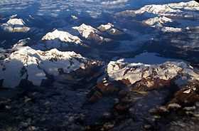 Aerial view of the Cordillera Blanca as seen from the east with Qaqapampa in the center (the one with three spots of snow on its eastern slope) | |
| Elevation | 5,500 m (18,000 ft)[1] |
| Location | |
 Qaqapampa Peru | |
| Location | Peru, Ancash Region |
| Range | Andes, Cordillera Blanca |
| Coordinates | 9°19′19″S 77°19′15″W / 9.32194°S 77.32083°WCoordinates: 9°19′19″S 77°19′15″W / 9.32194°S 77.32083°W |
Qaqapampa (Quechua qaqa rock, pampa a large plain,[2] "rock plain", hispanicized spelling Jacabamba) is a mountain in the Cordillera Blanca in the Andes of Peru, about 5,500 metres (18,045 ft) high. It is situated in the Ancash Region, Asunción Province, Chacas District, in the Carhuaz Province, Marcará District, and in the Huari Province, Huari District. Qaqapampa lies between the mountain Perlilla in the north and Rurichinchay in the south. The Rurichinchay Lake lies at its feet.
The rivers Qaqapampa (Jacabamba) and Rurichinchay originate on the east side of the mountain and flow to the south-west. They belong to the watershed of the Marañón River.[1]