Pyrogi
| Pyrogi | |
|---|---|
| Πυρογι (Greek) Gaziler (Turkish) | |
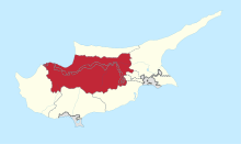
 Pyrogi Location in Cyprus | |
| Coordinates: 35°4′39″N 33°29′29″E / 35.07750°N 33.49139°ECoordinates: 35°4′39″N 33°29′29″E / 35.07750°N 33.49139°E | |
| Country |
de jure de facto |
| District |
de jure Nicosia District de facto Lefkoşa District |
| Time zone | EET (UTC+2) |
| • Summer (DST) | EEST (UTC+3) |
Pyrogi (Greek: Πυρόι; Turkish: Gaziler) is a village in Northern Cyprus, located south of Tymvou. Today it is largely uninhabited, as the village lies within military area and can only be visited with permission of the Turkish military. In 1960 the village had 460 inhabitants.[1] Two kilometres west of the town lies the also uninhabited former village of Margo.