Pyonggang County
| Pyonggang County 평강군 | |
|---|---|
| County | |
| Korean transcription(s) | |
| • Chosŏn'gŭl | 평강군 |
| • Hancha | 平康郡 |
| • McCune-Reischauer | P'yŏnggang kun |
| • Revised Romanization | Pyeonggang-gun |
 | |
| Country | North Korea |
| Province | Kangwon |
| Administrative divisions | 1 ŭp, 1 workers' district, 30 ri |
| Area | |
| • Total | 708 km2 (273 sq mi) |
| Population (1990 est.) | |
| • Total | 100,800 |
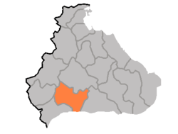
Pyonggang County is a kun, or county, in Kangwon province, North Korea. It borders Sepo to the north, Chorwon to the south, Ichon to the west, and Changdo to the east.
Physical features
A portion of the county is occupied by the Yongam wetland, which also crosses into Chorwon. Most of the county's terrain is mountainous, although there a few small expanses of level ground. The Kwangju Mountains and Machonryong Mountains pass through Pyonggang. The region is prone to heavy rains.
Political history
The Pyonggang area was known as Puyang hyŏn during the Goguryeo period, and as Kangpyong (강평) under Silla. In the Goryeo Dynasty, it was included in Tongju (동주); in the Joseon Dynasty, it took its modern name.
On August 15, 1945, It includes 1 eup(Pyonggang), 6 myeon(Seo, Nam, Hyonnae, Mokjeon, Sepo, Yujin).
Economy
The county is well-suited to agriculture, and rice farming is especially developed. In addition, the mines of Pyonggang extract gold, tungsten, nepheline, zircon, alunite, and diatomaceous earth.
Transport
Pyonggang is served by road and rail, with the Kyongwon Line railroad and Kyongwon Highway both passing through the county. Pyonggang Station is on the Kangwon Line.
See also
- Geography of North Korea
- Administrative divisions of North Korea
- Kangwon (North Korea)
External links
- (Korean) In Korean language online encyclopedias:
| ||||||||||||||||