Pukë
| Pukë | |
|---|---|
| Municipality | |
 | |
 Pukë | |
| Coordinates: 42°03′N 19°54′E / 42.050°N 19.900°ECoordinates: 42°03′N 19°54′E / 42.050°N 19.900°E | |
| Country |
|
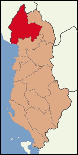
| County | Shkodër |
| Government | |
| • Mayor | Beqir Arifaj |
| Area | |
| • Total | 40.21 km2 (15.53 sq mi) |
| Elevation | 890 m (2,920 ft) |
| Population (2011) | |
| • Total | 3,607 |
| • Density | 90/km2 (230/sq mi) |
| Time zone | CET/CEST (UTC+1/+2) |
| Postal code | 4401 |
| Area code | 0212 |
| Car plates | PU |
| Website | http://www.bashkiapuke.al |
Pukë is a municipality in northern Albania. The population at the 2011 census was 3,607.[1] The local football club is called KS Tërbuni Pukë.
At 838 metres above sea level, the town is one of the highest in elevation in Albania and a well known ski area. It is 150 km from Albania's capital, Tirana. Situated on the road from the Adriatic to Kosovo, the town developed during the 4th–2nd centuries B.C. In ancient times, it was known as Picarea. The ancient town was destroyed by a barbarian invasion. The town has also been known as Pezhve. This area has a 2,000-year-old tradition of resin sculpture. The remains of this tradition are located in a quarter of Pukë town. In the 20th century, Pukë was expanded as a military base and a centre of Catholic Education. The distinguished Albanian poet Migjeni worked there from 1936 to 1937. The school where he worked as a teacher is a tourist attraction. The town is surrounded by a 400-hectare massif covered with pine trees. Since the end of the communist era, there has been a spread of disease in the pines caused by pine processionary moths, whose nests are conspicuous.
The hotel standing in the town square has been upgraded and now boasts a micro brewery producing Puka Beer, which is a lager in draught form.
The name Pukë comes from Latin via publica "public road" as it was located on an old trade route.
References
- Through The Embers of Chaos ISBN 0-7195-6232-5 (2002) Dervla Murphy
The author refers to processionary disease in Pukë on a cycle trip through Albania, including a stay in the town, described on page 213
See also
- Berishe
- Dardhe
- List of ski areas and resorts in Europe
External links
| Wikimedia Commons has media related to Pukë. |
- Official website
- Hotel Turizem Puka Official Website
- Pukë A Web page dedicated to Pukë and the surrounding area
| |||||||||||||||||||||