Pujehun District
| Pujehun District | |
|---|---|
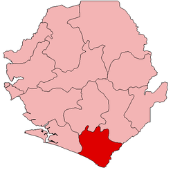 Location of Pujehun District in Sierra Leone | |
| Coordinates: 7°20′N 11°30′W / 7.333°N 11.500°WCoordinates: 7°20′N 11°30′W / 7.333°N 11.500°W | |
| Country | Sierra Leone |
| Province | Southern Province |
| Capital | Pujehun |
| Largest city | Pujehun |
| Government | |
| • Type | District Council |
| • Council Chairman | Sadiq Sillah[1] (SLPP) |
| Area | |
| • Total | 4,105 km2 (1,585 sq mi) |
| Population (2010 estimate)[2] | |
| • Total | 292,543 |
| Time zone | Greenwich Mean Time (UTC-5) |
Pujehun District is a district in the Southern Province of Sierra Leone. Its capital is the town of Pujehun .[3][4] The other major towns in the district include Gandorhun, Zimmi, Gendema, Masam, Bomi and Potoru. As of 2010, the district has an estimated population of 292,543.[2] The population of Pujehun District is largely from the Mende ethnic group; and the district is predominantly muslim.
The district of Pujehun borders the Atlantic Ocean in the southwest, the Republic of Liberia to the southeast, Kenema District to the northeast, Bo District to the north and Bonthe District to the west. It occupies a total space of 4,105 km² and comprises twelve chiefdoms.
History
In 1982 the Ndogboyosoi (bush devil) War was fought in the district.[5]
Geography
Pujehun District is located at the southeast corner of Sierra Leone bordering Atlantic Ocean in the southwest and the Liberia to the southeast. The climate is tropical with a wet and dry seasons. At the 2004 census the population of Pujehun district was 234,234[6] the estimated population in 2010 was 276,970.[6] The district has one of the lowest population densities of Sierra Leone, with most people living in villages of less than 2000 residents.[7]
Economy
Diamond mining is a major economic activity in the district, as well as agricultural production of cassava, coffee, and cacao.
Government
Pejehun district currently has nine Representatives in the Sierra Leonean Parliament, of which eight members were elected to a 5-year term. Below are Pejehun district Representatives in the Parliament:
- Brima Victor Sidi Kebbie - Paramount Chief of Pejehun district
- Ansumana Jaia Kaikai (SLPP)
- Mana Kpaka (SLPP)
- Mary Mansaray (SLPP)
- Sidie Tunis (SLPP)
- Lawrence Mohamed Kamara (SLPP)
- Momoh Koya (SLPP)
- John Kallon (SLPP)
- Siaka Magona (SLPP)
References
- ↑ For 50th Independence anniversary celebrations… Pujehun District establishes coordinating committee « Awoko Newspaper
- ↑ 2.0 2.1 http://archive.is/20130209125449/http://www.world-gazetteer.com/wg.php?x=&men=gpro&lng=en&des=wg&srt=npan&col=abcdefghinoq&msz=1500&geo=-6645
- ↑ Remmert-Fontes, Inge (2006), (Extract from) Evaluation Report "Peace building projects in Sierra Leone" (PDF), Freetown, Sierra Leone, p. 32
- ↑ Boland, Sarah (8 February 2011). "Sierra Leone: Buzz of excitement in the air in Pujehun". Save the Children. Retrieved 23 February 2011.
- ↑ Notholt, Stuart (2008). Fields of Fire - An Atlas of Ethnic Conflict. Lulu.com. p. 2.43. ISBN 978-0-9556876-0-0.
- ↑ 6.0 6.1 "Pujehun". World Gazetteer. 2010. Retrieved 23 February 2011.
- ↑ Thomas, Christopher (1994). People's participation programme in Pujehun, Sierra Leone: post-project study. Food and Agriculture Organization of the United Nations. p. 5. ISBN 978-92-5-103466-8.
External links
| ||||||||||||
