Puerto Baquerizo Moreno
| Puerto Baquerizo Moreno | |||
|---|---|---|---|
| City | |||
|
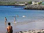
The shoreline of Puerto Baquerizo with a sea lion in the foreground | |||
| |||
| Motto: "Capital del Paraíso" - "Paradise's Capital" | |||
 Puerto Baquerizo Moreno | |||
| Coordinates: 00°54′09″S 89°36′33″W / 0.90250°S 89.60917°WCoordinates: 00°54′09″S 89°36′33″W / 0.90250°S 89.60917°W | |||
| Country |
| ||
| Province |
| ||
| Canton |
| ||
| Government | |||
| • Mayor | Ab. Pedro Zapata | ||
| Area | |||
| • City | 109.60 km2 (42.32 sq mi) | ||
| • Metro | 848.50 km2 (327.61 sq mi) | ||
| Elevation | 2 m (7 ft) | ||
| Population (2010 census) | |||
| • City | 6,672 | ||
| • Density | 61/km2 (160/sq mi) | ||
| • Metro | 7,475 | ||
| Website |
www | ||


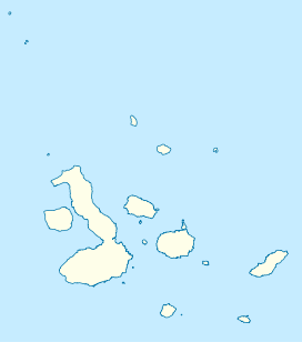
Puerto Baquerizo Moreno is the capital of the Galápagos Province, in Ecuador. It is located along the southwestern coast of San Cristóbal, the easternmost island in the archipelago, and is the capital of San Cristóbal Canton.
Overview
Even though it is the capital, the town has the second largest population: 6,672 inhabitants, mainly fishermen. The primary industries are artisan fishing, tourism, and arable farming. The town includes an Interpretation Center, but its tourism infrastructure is not as advanced as in Puerto Ayora.
The city takes its name from the president Alfredo Baquerizo Moreno (1859-1951), the first president to visit the Galápagos Islands during his presidency.
Residents founded and still operate the Albatross Foundation USA.
Climate
Puerto Baquerizo Moreno has an atypical arid climate (Köppen climate classification BWh).
Despite being less than one full latitudinal degree away from the Equator, temperatures in the town and the surrounding area on the island never reach the unbearable heights expected for such an equatorial location. Temperatures remain astonishingly similar year-round, fluctuating only several degrees from January means to July means.
However, two seasons predominate: the cooler, dry season that typically lasts from June to November and brings light drizzle, oceanic coastal fog, mild to warm temperatures, and mainly overcast skies. All of these characteristics are evident due to the presence of the cold Humboldt Current that flows north from Peru and Chile. Although this is considered the dry season for the actual total rain amount at this time is exceptionally light, it tends to precipitate very slowly in the form of extremely light drizzle and is often accompanied with grey, overcast skies.
The wet season lasts roughly from December to March, and brings an abundance of bright sunshine along with sporadically brief, yet often intense, tropical thunderstorms. Annual average precipitation amounts to approximately 288.8 mm (11.37 in), 86% of which falls in the five-month wet season period spanning December till May. Precipitation falls an average of 107 days a year (precipitation ≥ 0.004" / 0.1 mm).
| Climate data for Puerto Baquerizo Moreno, San Cristobal, Galapagos Islands, Ecuador | |||||||||||||
|---|---|---|---|---|---|---|---|---|---|---|---|---|---|
| Month | Jan | Feb | Mar | Apr | May | Jun | Jul | Aug | Sep | Oct | Nov | Dec | Year |
| Average high °F (°C) | 84 (29) |
86 (30) |
86 (30) |
86 (30) |
84 (29) |
81 (27) |
77 (25) |
75 (24) |
75 (24) |
77 (25) |
79 (26) |
81 (27) |
80.9 (27.2) |
| Daily mean °F (°C) | 79 (26) |
80 (27) |
80 (27) |
80 (27) |
78 (26) |
75 (24) |
72 (22) |
71 (22) |
70 (21) |
72 (22) |
73 (23) |
75 (24) |
75.4 (24.3) |
| Average low °F (°C) | 73 (23) |
73 (23) |
73 (23) |
73 (23) |
72 (22) |
70 (21) |
66 (19) |
66 (19) |
64 (18) |
66 (19) |
68 (20) |
70 (21) |
69.5 (20.9) |
| Average rainfall inches (mm) | 1.89 (48) |
2.64 (67.1) |
3.35 (85.1) |
1.38 (35.1) |
0.63 (16) |
0.08 (2) |
0.16 (4.1) |
0.20 (5.1) |
0.28 (7.1) |
0.28 (7.1) |
0.20 (5.1) |
0.28 (7.1) |
11.37 (288.9) |
| Avg. rainy days (≥ 0.004 inch / 0.1 mm) | 12 | 8 | 7 | 5 | 4 | 4 | 12 | 11 | 13 | 11 | 9 | 11 | 107 |
| Mean monthly sunshine hours | 176.7 | 212.8 | 232.5 | 234.0 | 238.7 | 228.0 | 192.2 | 173.6 | 144.0 | 161.2 | 165.0 | 179.8 | 2,338.5 |
| Source: ClimateTemps [1] | |||||||||||||
Gallery
-

The coastline
-
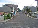
A town's road
-
View of the beach
-

Harbor seen from Playa Mann
Sister cities
 Chapel Hill, North Carolina (USA)[2]
References
- ↑ "Puerto Baquerizo Moreno, San Cristobal, Galapagos Islands". www.climatemps.com. Retrieved 2012-12-05.
- ↑ "Sister Cities: Chapel Hill & San Cristobal". Center for Galapagos Studies Development. 2011. Retrieved 15 July 2011.
External links
![]() Media related to Puerto Baquerizo Moreno at Wikimedia Commons
Media related to Puerto Baquerizo Moreno at Wikimedia Commons
| |||||||||||||||||||||||||