Pudtol, Apayao
| Pudtol | |
|---|---|
| Municipality | |
|
Pudtol Church Ruins | |
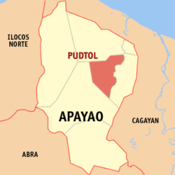 Map of Apayao showing the location of Pudtol | |
.svg.png) Pudtol Location within the Philippines | |
| Coordinates: 18°09′N 121°17′E / 18.150°N 121.283°ECoordinates: 18°09′N 121°17′E / 18.150°N 121.283°E | |
| Country | Philippines |
| Region | Cordillera Administrative Region (CAR) |
| Province | Apayao |
| District | Lone District |
| Barangays | 22 |
| Government[1] | |
| • Mayor | Batara P. Laoat |
| Area[2] | |
| • Total | 401.02 km2 (154.83 sq mi) |
| Population (2010)[3] | |
| • Total | 13,305 |
| • Density | 33/km2 (86/sq mi) |
| Time zone | PST (UTC+8) |
| ZIP code | 3812 |
| Dialing code | 74 |
| Income class | 4th class |

Pudtol is a fourth class municipality in the province of Apayao, Philippines. According to the 2010 census, it has a population of 13,305 people.[3]
Pudtol, Flora, and Santa Marcela were originally territories of Luna before they gained their own municipal status.
Barangays
Pudtol is politically subdivided into 22 barangays.[2]
- Aga
- Alem
- Cabatacan
- Cacalaggan
- Capannikian
- Lower Maton
- Malibang
- Mataguisi
- Poblacion
- San Antonio (Pugo)
- Swan
- Upper Maton
- Amado
- Aurora
- Doña Loreta
- Emilia
- Imelda
- Lt. Balag
- Lydia
- San Jose
- San Luis
- San Mariano
Demographics
| Population census of Pudtol | ||
|---|---|---|
| Year | Pop. | ±% p.a. |
| 1990 | 7,621 | — |
| 1995 | 8,656 | +2.41% |
| 2000 | 11,039 | +5.35% |
| 2007 | 12,595 | +1.84% |
| 2010 | 13,305 | +2.02% |
| Source: National Statistics Office[3] | ||
References
- ↑ "Official City/Municipal 2013 Election Results". Intramuros, Manila, Philippines: Commission on Elections (COMELEC). 11 September 2013. Retrieved 2 January 2014.
- ↑ 2.0 2.1 "Province: APAYAO". PSGC Interactive. Makati City, Philippines: National Statistical Coordination Board. Retrieved 2 January 2014.
- ↑ 3.0 3.1 3.2 "Total Population by Province, City, Municipality and Barangay: as of May 1, 2010". 2010 Census of Population and Housing. National Statistics Office. Retrieved 2 January 2014.
External links
 |
Luna | | ||
| Kabugao | |
Flora | ||
| ||||
| | ||||
| Kabugao |
| ||||||||||||||