Provincial Highway 2 (Taiwan)
Provincial Highway No. 2 (台2線) is an east-west, 166.6 km-long provincial Taiwanese highway that starts from the border of Taipei and Tamsui and ends in Su'ao, Yilan. Although designed as an east-west route, the highway actually goes in north-south direction in Yilan County and parts of New Taipei City. The highway serves as the primary road for the north coast cities in Taiwan.
Major cities and districts along the route
Spur routes

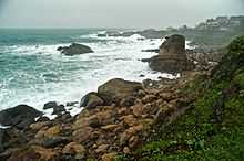
Views from the highway on a stormy day
- Highway 2A (台2甲): Also known as Yangjin Highway (陽金公路) for most part, the road connects downtown Taipei to Jinshan District, via Yangmingshan National Park located in north Taipei. The total length is 37.3 km (23.2 mi).
- Highway 2B (台2乙): This route is the old Highway 2 segment that continues on to Taipei. The route starts from downtown Taipei and ends in Tamsui. The total length is 25.7 km.
- Highway 2C (台2丙): This route is only partially completed; when the route is completed it will go from Keelung to Gongliao, connecting the mountain towns in northeast New Taipei City. The total length is 29.6 km.
- Highway 2D (台2丁): This route connects National Highway No. 1 and Highway 2, bypassing downtown Keelung. The total length is 13.2 km.
- Highway 2E (台2戊): This route is the old Highway 2 segment in Yilan County, and goes from Wujie to Su'ao. The total length is 12.1 km.
- Highway 2F (台2己): This route connects Port of Keelung and National Highway No. 3 and is used as an alternate route for trucks. The total length is 4 km.
- Highway 2G (台2庚): This route connects National Highway No.5, Highway 9 and Highway 2 in Yilan County. The total length is 3.7 km.
External links
Provincial Highways of Taiwan |
|---|
| | |
|

