Province of Sondrio
Coordinates: 46°21′37″N 9°56′38″E / 46.3601976°N 9.9440002°E
| Province of Sondrio | |
|---|---|
| Province | |
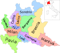
 Map highlighting the location of the province of Sondrio in Italy | |
| Country |
|
| Region | Lombardy |
| Capital(s) | Sondrio |
| Comuni | 78 |
| Government | |
| • President | Massimo Sertori (LN) |
| Area | |
| • Total | 3,212 km2 (1,240 sq mi) |
| Population (2012) | |
| • Total | 183,392 |
| • Density | 57/km2 (150/sq mi) |
| Time zone | CET (UTC+1) |
| • Summer (DST) | CEST (UTC+2) |
| Telephone prefix | 0342, 0343 |
| Vehicle registration | SO |
| ISTAT | 014 |

The Province of Sondrio (It. Provincia di Sondrio; German: Provinz Sondrio) is in the Lombardy region of Italy. Its capital is the town of Sondrio.
It has an area of 3,212 square kilometres (1,240 sq mi), and a total population of about 200,000. There are 78 communes in the province, ranging in population from Sondrio (21,790 persons) to Pedesina (only 34 inhabitants) and in size from Valdidentro (244.41 km²) to Poggiridenti (2.93 km²) (source: Italian institute of statistics Istat, see this link).
The province borders Switzerland (precisely, the Canton of Grisons) to the north and west, the provinces of Como and Lecco to the west, the provinces of Bergamo and Brescia to the south and Trentino-Alto Adige/Südtirol region to the east.
Most populous communes
Below is a list of the top ten municipalities in the province of Sondrio sorted by number of inhabitants:
| Rank | City | Population | Area (km2) |
Density (inhabitants/km2) |
Altitude (mslm) |
|---|---|---|---|---|---|
| 1st | Sondrio | 22,325 | 20.43 | 1093 | 286 |
| 2nd | Morbegno | 12,195 | 15.39 | 792 | 262 |
| 3rd | Tirano | 9,221 | 32.47 | 284 | 441 |
| 4th | Chiavenna | 7,385 | 11.09 | 666 | 333 |
| 5th | Livigno | 6,105 | 210.79 | 29 | 1,816 |
| 6th | Cosio Valtellino | 5,471 | 23.93 | 229 | 231 |
| 7th | Talamona | 4,801 | 21.24 | 226 | 285 |
| 8th | Teglio | 4736 | 115.23 | 41 | 900 |
| 9th | Grosio | 4,610 | 126.93 | 36 | 656 |
| 10th | Berbenno di Valtellina | 4,338 | 35.70 | 122 | 370 |
External links
| ||||||||||