Prairie Township, Audrain County, Missouri
| Prairie Township | |
|---|---|
| Township | |
 | |
| Coordinates: 39°15′44″N 091°41′41″W / 39.26222°N 91.69472°WCoordinates: 39°15′44″N 091°41′41″W / 39.26222°N 91.69472°W | |
| Country | United States |
| State | Missouri |
| County | Audrain |
| Area | |
| • Total | 79.02 sq mi (204.65 km2) |
| • Land | 78.69 sq mi (203.80 km2) |
| • Water | 0.33 sq mi (0.85 km2) 0.42% |
| Elevation[1] | 774 ft (236 m) |
| Population (2010) | |
| • Total | 932 |
| • Density | 12/sq mi (4.6/km2) |
| FIPS code | 29-59474[2] |
| GNIS feature ID | 0766244 |
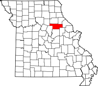
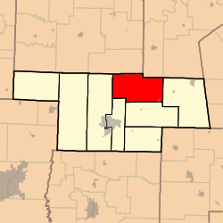
Prairie Township is one of eight townships in Audrain County, Missouri, United States. As of the 2010 census, its population was 932.[3]
History
Prairie Township was named from its prairie landscape.[4]
Geography
Prairie Township covers an area of 79.0 square miles (204.6 km2) and contains one incorporated settlement, Laddonia. It contains three cemeteries: Bean Creek, Eubank and Unity.
The streams of Bean Creek, Hazel Creek, Littleby Creek, Sandy Creek, Talleys Branch, Tattys Creek and Wildcat Creek run through this township.
Transportation
Prairie Township contains one airport or landing strip, Schlemmer Airport.
References
- ↑ "US Board on Geographic Names". United States Geological Survey. 2007-10-25. Retrieved 2008-01-31.
- ↑ "American FactFinder". United States Census Bureau. Retrieved 2008-01-31.
- ↑ "Geographic Identifiers: 2010 Demographic Profile Data (G001): Prairie township, Audrain County, Missouri". U.S. Census Bureau, American Factfinder. Retrieved June 25, 2013.
- ↑ Eaton, David Wolfe (1916). How Missouri Counties, Towns and Streams Were Named. The State Historical Society of Missouri. p. 204.
External links
| |||||||||||||||||||||||||||||