Povoação Velha
| Povoação Velha | |
|---|---|
| Settlement | |
 | |
 Povoação Velha | |
| Coordinates: 16°02′17″N 22°55′01″W / 16.038°N 22.917°WCoordinates: 16°02′17″N 22°55′01″W / 16.038°N 22.917°W | |
| Country | Cape Verde |
| Island | Boa Vista |
| Municipality | Boa Vista |
| Civil parish | Santa Isabel |
| Population (2010)[1] | |
| • Total | 309 |
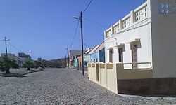
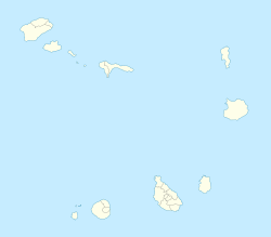
Povoação Velha (Cape Verde Creole: Povoason Bédja) is a village in the southwestern part of the island of Boa Vista, Cape Verde.[2][3] The village is around 16 km south of the island capital of Sal Rei.
Geography

Povoação Velha is situated at the foot of 348 m high Rocha Estância.[4][5] The sandy beach Praia de Santa Mónica stretches south of the village. Landmarks include the Chapel of Santo António (Saint Anthony) built in 1800, the church of Nossa Senhora da Conceição[6] and Praceta de Santo António in the center. There is a health center in the village.[7]
About 15 km towards the east, on the south coast of the island, is the deserted village Curral Velho.
History
The community is the oldest settlement in the island dating back to the late 16th century, its population used to be 1,500.[4] Until 1810, it served as an island capital. The capital was moved to Rabil for its paper production and later Sal Rei for its exploration and the production of salt.[8]
Gallery
-

Nossa Senhora da Conceição
-

View of the village
-

Povoação Velha welcome signs
See also
| Wikimedia Commons has media related to Povoação Velha. |
- List of villages and settlements in Cape Verde
References
- ↑ "2010 Census results". Instituto Nacional de Estatística Cabo Verde (in Portuguese). 17 March 2014.
- ↑ Cape Verde Islands pocket guide, Emma Gregg, Berlitz, 2009
- ↑ SDTIBM
- ↑ 4.0 4.1 A semana, December 12, 2008
- ↑ Proposta de Plano de Gestão de Zonas Húmidas - Boavista/ Cabo Verde, páginas 59 a 63, Ministério do Ambiente e Agricultura, http://www.sia.cv (Portuguese)
- ↑ http://www.capeverde.com/islands/boa-vista.html
- ↑ Ministério da Saúde de Cabo Verde, Relatório Estatístico, 2005
- ↑ Boletim da Sociedade de Geographia de Lisboa, Volume 6, 1886
| ||||||||||||||||||