Poundon
| Poundon | |
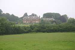 Poundon House |
|
 Poundon |
|
| Population | 114 [1] |
|---|---|
| OS grid reference | SP645255 |
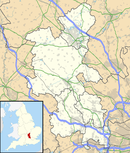
| District | Aylesbury Vale |
| Shire county | Buckinghamshire |
| Region | South East |
| Country | England |
| Sovereign state | United Kingdom |
| Post town | BICESTER |
| Postcode district | OX27 |
| Dialling code | 01869 |
| Police | Thames Valley |
| Fire | Buckinghamshire |
| Ambulance | South Central |
| EU Parliament | South East England |
| UK Parliament | Buckingham |
|
|
Coordinates: 51°55′29″N 1°03′34″W / 51.9246°N 1.0594°W
Poundon is a hamlet and also a civil parish within Aylesbury Vale district in Buckinghamshire, England. It is located near the Oxfordshire border, about four miles north east of Bicester, three miles south west of Steeple Claydon.
The village name is Anglo Saxon in origin, though its meaning is uncertain. In manorial rolls of 1255 it was recorded as Paundon.
During the Second World War Poundon was the site of stations 53b and 53c of the Special Operations Executive (SOE). Just outside the village is Tower Hill Business Park. This was previously Poundon Hill Wireless Station, a FCO/MI6 signals intelligence station. [2] [3]
References
- ↑ Neighbourhood Statistics 2011 Census, Accessed 3 February 2013
- ↑ Turnbull, Alan (24 August 2006). ""Secret Bases" Part 1". Pagliacci Productions Limited. Retrieved 2006-08-30.
- ↑ "Get-a-map - Poundon Hill". Ordnance Survey. Retrieved 2006-08-30.