Port of Djibouti
| Port of Djibouti | |
|---|---|
|
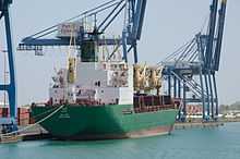
Boats in front of a container terminal at the Port of Djibouti. | |
| Location | |
| Country | Djibouti |
| Location | Djibouti City |
| Details | |
| Operated by | Djibouti Ports & Free Zones Authority |
|
Website www | |

The Port of Djibouti is a port in Djibouti City, the capital of Djibouti. It is strategically located at the crossroads of one of the busiest shipping routes in the world, linking Europe, the Far East, the Horn of Africa and the Persian Gulf. The port serves as a key refueling and transshipment center, and is the principal maritime outlet for imports to and exports from neighboring Ethiopia.
History

Djibouti as a main maritime passage and a main trading route between East and West stretches back 3,500 years, the time of maritime explorations of the Red Sea. A strategic meeting point between Northeast Africa and the Arabian Peninsula, the Red Sea was a place of contact and passage used by the Egyptians, the Phoenicians, the Ptolemaists, the Romans, the Greeks, the Byzantines, the Arabs, and then by the Europeans in search of the Spice route. Its apogee came with the opening of the Suez Canal.
The port evolved out of Ethiopia's search for a maritime outlet to its railway line, and Djibouti’s coastline provided both easy access and sheltered anchorage. Work on the railway began in 1897, as did the initial construction of the port. Once the line was completed in 1917, the port grew rapidly. The Ethio-Djibouti Railways is in process of rehabilitation to increase its capacity.
Development at the port increased further between 1948 and 1957 with the construction of four deep-water quays and the dredging of the port access channels. On land, new warehouses and oil storage facilities were built, electricity and water supplies provided and railway lines laid.
In 1952, the French oil company Pétroles de Somalie (now known as Total S.A.) bunkered their first ship, and in 1956, Mobil Oil set up in Djibouti.
Between 1960 and 1970, port activity was developed as part of an international maritime exchange network. The Red Sea had become one of the busiest shipping lanes in the world, and Djibouti found itself acting as its service station. Bunkering traffic quadrupled in the ten years from 1954, reaching a peak of 1.8 million tons in 1965.
Regional hub and future
Djibouti's strategic location enabled the port authorities to successfully rise to the challenge of turning the port into a regional hub for the Red Sea and Indian Ocean, and in a wider context the three continents of Europe, Africa and Asia. Containerization was the defining concept behind this new period of development and Djibouti’s first modern container terminal began operations in February 1985.
About 70% of the seaport's activity consists of imports to and exports from neighboring Ethiopia, which depends on the harbour as its main maritime outlet. The port also serves as an international refueling center and transshipment hub.[1] In 2012, the Djiboutian government in collaboration with DP World started construction on the Doraleh Container Terminal,[2] a third major seaport intended to further develop the national transit capacity.[1] A $396 million project, it has the capacity to accommodate 1.5 million twenty foot container units annually.[2]
As of 2013, the Djibouti Ports & Free Zones Authority (DPFZA) is the governmental body administering the Port of Djibouti and other ports in the country. The organization also oversees the national free zones, serving as a liaison between the companies working therein and other government agencies. The DPFZA is subject to the Presidential Office.[3]
See also
Notes
- ↑ 1.0 1.1 "CIA World Factbook - Djibouti". The World Factbook. CIA. Retrieved February 27, 2013.
- ↑ 2.0 2.1 Bansal, Ridhima. "Current Development Projects and Future Opportunities in Djibouti". Association of African Entrepreneurs. Retrieved 26 February 2013.
- ↑ "DPFZA". Djibouti Ports & Free Zones Authority. Retrieved 29 September 2013.
References
- "Port de Djibouti". Port de Djibouti. Retrieved 29 September 2013.