Port Mathurin
| Port Mathurin | |
|---|---|
|
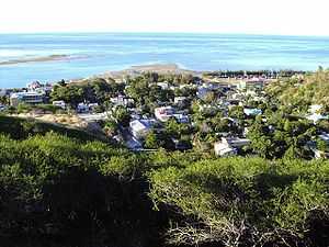
Port Mathurin as seen from Mount Fanal | |
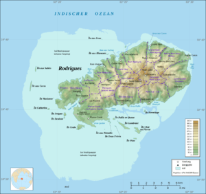
 14 Zones of Rodrigues, with Port Mathurin due north | |
| Coordinates: 19°41′S 63°25′E / 19.683°S 63.417°E | |
| Country |
|
| Island | Rodrigues |
| Population | |
| • Total | 6,000 |
| Time zone | MUT (UTC+4) |
The village of Port Mathurin serves as the capital of the island of Rodrigues, a dependency of Mauritius. It lies on the north coast of the Indian-Ocean island and functions as the administrative, judicial and economic centre of Rodrigues. As the name suggests, it also operates the main harbour of the island.
Port Mathurin has a population of around 6,000 people (2006). Sights include its market, while the town also has the island's only bus station and a viewpoint on Mount Fanal, south of the town. There is a Roman Catholic church, an Anglican church, and a small mosque. The two ships of the Mauritius Cargo Handling Corporation, namely MV Mauritius Pride and Mauritius Trochetia, anchor at Port Mathurin five times every month.
On May 1, 1691, François Leguat and the first French landed on Rodrigues at the site of the future village, which was founded by French colonists in 1735. The place takes its name from that of an early French settler, either Mathurin Bréhinier or Mathurin Morlaix.
In 1901 Port Mathurin became home to offices for the Britain-Australia undersea cable.
There are 22 localities within the zone of Port Mathurin, which is one of 14 statistical subdivisions of Rodrigues, to which the population of 6,000 relates:[1]
- Baie Lascars (North)
- Camp du Roi
- Castor
- Caverne Provert
- Citronelle
- Crève Coeur
- Désiré
- English Bay
- Fond La Digue
- Jentac
- Mont Piton
- Mont Vénus
- Montagne Charlot
- Montagne Fanal
- Pointe Canon
- Pointe Monnier
- Port Mathurin
- Roseaux
- Solitude
- Soupir
- Terre Rouge
- Vangar
The village (locality) has a single secondary school: Rodrigues College. (Other colleges operate in other villages around the island, namely Le Chou, Marechal, Grand Montagne, Mont Lubin and Citron Donis.)
The locality of Port Mathurin proper occupies a very small area, and neighbouring settlements (localities) include Fond La Digue, Montagne Fanal, Pointe Monier, Camp du Roi and Baie Lascar.
