Port Jefferson, Ohio
| Port Jefferson, Ohio | |
|---|---|
| Village | |
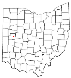 Location of Port Jefferson, Ohio | |
| Coordinates: 40°19′50″N 84°5′28″W / 40.33056°N 84.09111°WCoordinates: 40°19′50″N 84°5′28″W / 40.33056°N 84.09111°W | |
| Country | United States |
| State | Ohio |
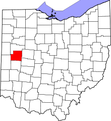
| County | Shelby |
| Area[1] | |
| • Total | 0.19 sq mi (0.49 km2) |
| • Land | 0.17 sq mi (0.44 km2) |
| • Water | 0.02 sq mi (0.05 km2) |
| Elevation[2] | 971 ft (296 m) |
| Population (2010)[3] | |
| • Total | 371 |
| • Estimate (2012[4]) | 366 |
| • Density | 2,182.4/sq mi (842.6/km2) |
| Time zone | Eastern (EST) (UTC-5) |
| • Summer (DST) | EDT (UTC-4) |
| ZIP code | 45360 |
| Area code(s) | 937 |
| FIPS code | 39-64262[5] |
| GNIS feature ID | 1061565[2] |
Port Jefferson is a village in Salem Township, Shelby County, Ohio, United States. The population was 371 at the 2010 census.
History
First known as Pratt, the village adopted its present name when it was incorporated on April 18, 1842. Port Jefferson was located where the Sidney feeder canal connected with the Great Miami River. The purpose of the feeder was to provide a steady flow of water to the Miami Canal at the Lockington Locks. A large dam in the river east of Port Jefferson diverted the waters into the feeder.
Because Port Jefferson was the closest point on the canal system for the vast territory east of Sidney and Port Jefferson, it became an important center for commercial activity almost overnight. All grain, lumber, and other products north and east of town, destined for the canal, passed through it. The canal feeder at Port Jefferson was completed to Sidney by 1841, some 4 years before the Miami & Erie Canal was opened between Cincinnati and Toledo.
Samuel Rice heard about the bright economic prospects of the village in the early 1840s. After first touring a small underdeveloped town called Chicago in northern Illinois, he traveled here, evaluated the prospects of Port Jefferson, and chose to invest here. He purchased a substantial amount of property around the village, and waited.
During its heyday between 1845 and the 1860s, Port Jefferson almost rivaled Sidney in size and influence. Nearly 150 Port Jefferson men worked in the wooden products (barrels and staves) business. Four blacksmiths, including Epler and Johnson, were kept busy by the canal boat work. Gottlieb Allinger built a large mill on the canal in 1871, now the site of the locally famous Hussey's Restaurant. Three dry goods stores, three groceries, and a shoe shop blossomed.
Construction of two major railroads in Sidney by 1860 signaled the decline of the canal's importance and that of Port Jefferson as well. Samuel Rice's bet that his town would become a major Midwest trading center never materialized. However, local residents did refer to Port Jefferson as 'Little Chicago' for a number of years.
Geography
Port Jefferson is located at 40°19′50″N 84°05′28″W / 40.330423°N 84.090979°W.[6]
According to the United States Census Bureau, the village has a total area of 0.19 square miles (0.49 km2), of which 0.17 square miles (0.44 km2) is land and 0.02 square miles (0.05 km2) is water.[1]
Demographics
2010 census
As of the census[3] of 2010, there were 371 people, 142 households, and 97 families residing in the village. The population density was 2,182.4 inhabitants per square mile (842.6/km2). There were 158 housing units at an average density of 929.4 per square mile (358.8/km2). The racial makeup of the village was 100.0% White.
There were 142 households of which 31.7% had children under the age of 18 living with them, 53.5% were married couples living together, 12.7% had a female householder with no husband present, 2.1% had a male householder with no wife present, and 31.7% were non-families. 23.9% of all households were made up of individuals and 7% had someone living alone who was 65 years of age or older. The average household size was 2.61 and the average family size was 3.07.
The median age in the village was 36.6 years. 25.3% of residents were under the age of 18; 9.7% were between the ages of 18 and 24; 28.1% were from 25 to 44; 26.4% were from 45 to 64; and 10.5% were 65 years of age or older. The gender makeup of the village was 51.2% male and 48.8% female.
2000 census
As of the census[5] of 2000, there were 321 people, 122 households, and 90 families residing in the village. The population density was 2,084.8 people per square mile (826.3/km2). There were 128 housing units at an average density of 831.3 per square mile (329.5/km2). The racial makeup of the village was 99.69% White and 0.31% Asian.
There were 122 households out of which 29.5% had children under the age of 18 living with them, 58.2% were married couples living together, 9.8% had a female householder with no husband present, and 26.2% were non-families. 22.1% of all households were made up of individuals and 6.6% had someone living alone who was 65 years of age or older. The average household size was 2.63 and the average family size was 2.97.
In the village the population was spread out with 22.7% under the age of 18, 9.0% from 18 to 24, 34.6% from 25 to 44, 19.0% from 45 to 64, and 14.6% who were 65 years of age or older. The median age was 36 years. For every 100 females there were 103.2 males. For every 100 females age 18 and over, there were 108.4 males.
The median income for a household in the village was $34,306, and the median income for a family was $47,000. Males had a median income of $31,063 versus $21,154 for females. The per capita income for the village was $16,897. About 5.0% of families and 8.3% of the population were below the poverty line, including none of those under age 18 and 18.4% of those age 65 or over.
References
- ↑ 1.0 1.1 "US Gazetteer files 2010". United States Census Bureau. Retrieved 2013-01-06.
- ↑ 2.0 2.1 "US Board on Geographic Names". United States Geological Survey. 2007-10-25. Retrieved 2008-01-31.
- ↑ 3.0 3.1 "American FactFinder". United States Census Bureau. Retrieved 2013-01-06.
- ↑ "Population Estimates". United States Census Bureau. Retrieved 2013-06-17.
- ↑ 5.0 5.1 "American FactFinder". United States Census Bureau. Retrieved 2008-01-31.
- ↑ "US Gazetteer files: 2010, 2000, and 1990". United States Census Bureau. 2011-02-12. Retrieved 2011-04-23.
| |||||||||||||||||||||||||||||