Poppasquash Farms Historic District
|
Poppasquash Farms Historic District | |
 | |
|
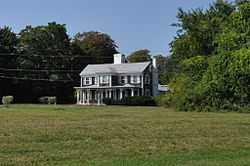
House on Poppasquash Road | |
 | |
| Location | Off RI 114, Bristol, Rhode Island |
|---|---|
| Coordinates | 41°40′45″N 71°17′44″W / 41.67917°N 71.29556°WCoordinates: 41°40′45″N 71°17′44″W / 41.67917°N 71.29556°W |
| Built | 1680 |
| Architect | Multiple |
| Architectural style | Greek Revival, Colonial, Queen Anne |
| Governing body | State |
| NRHP Reference # | 80000075[1] |
| Added to NRHP | June 27, 1980 |
Poppasquash Farms Historic District is a historic district in Bristol, Rhode Island. It was added to the National Register of Historic Places in 1980.[1]
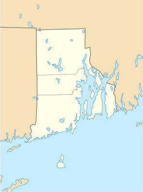
The district is located off Route 114, and encompasses most of Colt State Park and about 50 acres (20 ha) of adjacent private lands on the northern half of Poppasquash Neck.
The area was occupied by Wampanoag Indians for hundreds of years and eventually settled by British colonists in the 17th century after King Philip's War. There is a broad array of architecture in the district including Greek Revival and Colonial houses.[2]
See also
References
| Wikimedia Commons has media related to Poppasquash Farms Historic District. |
- ↑ 1.0 1.1 "National Register Information System". National Register of Historic Places. National Park Service. 2009-03-13.
- ↑ Richard V. Simpson, Bristol: Montaup to Poppasquash, (Arcadia Publishing, 2001) ISBN 0-7385-2356-9, ISBN 9780738523569
External links
| ||||||||||||||||||||||||||