Pondicherry
| Pondicherry பாண்டிச்சேரி Puducherry | |
|---|---|
|
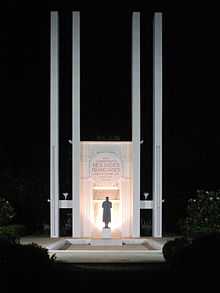
Park Monument (Aayi Mandapam) in the Government Park of Pondicherry | |
| Nickname(s): Pondy | |
 Pondicherry | |
| Coordinates: 11°55′51″N 79°47′07″E / 11.930965°N 79.785182°ECoordinates: 11°55′51″N 79°47′07″E / 11.930965°N 79.785182°E | |
| Country |
|
| State | Puducherry |
| District | Pondicherry |
| Established | 1673 |
| Elevation | 3 m (10 ft) |
| Population (2011) | |
| • Total | 654,392 |
| • Density | 9,166/km2 (23,740/sq mi) |
| Languages Tamil, French, Telugu, Malayalam | |
| Time zone | IST (UTC+5:30) |
| PIN CODE | 605001-605014 |
| Telephone code | 91 (0)413 |
| Vehicle registration | PY-01 |

Pondicherry (/pɒndɨˈtʃɛri/ or /pɒndɨˈʃɛri/) or Puducherry is a city, an urban agglomeration and a municipality in Pondicherry district in the Indian union territory of Puducherry. It is affectionately known as Pondy, and has been officially known by the alternative name Puducherry since 2006.
History

The history of the City of Pondicherry is recorded only after the period of colonial rule by the Dutch, Portuguese, British and the French. By contrast, nearby places like Arikamedu, Ariyankuppam, Kakayanthoppe, Villianur, Bahur which were annexed by the French East India Company over a period of time and which became the Union Territory of Pondicherry after Independence have recorded history predating the Colonial period.
A marketplace named Poduke or Poduca is recorded as a Roman trading destination from the mid 1st century. The area was part of the Pallava Kingdom of Kanchipuram in the 4th century. The Cholas of Thanjavur held it from the 10th to 13th centuries, only to be replaced by the Pandya Kingdom in the 13th century. The Vijayanagar Empire took control of almost all the South of India in the 14th century and lasted until 1638, to be supplanted by the Sultan of Bijapur. The French acquired Puducherry in 1674 and held control, with occasional interruption from the British and Dutch, until 1954 (de jure in 1956), when it was incorporated into the Indian Union along with the rest of French India.
On 18 October 1954 conducted a general election with 178 people in Pondicherry Municipal and Commune Panchayat. 170 people were in favor of independence, in which 8 people voted against. On 1 November 1954,The union was released to Puducherry.
However, formal agreement was signed 16 August. That date celebrated as Independence Day of the Puducherry. Following the demands of the French India Viduthalai Kaala Makkal Iyyakkam to their current CM of Puducherry. So 1 November be declared as the Independence Day of Puducherry and 16 August as the Republic Day.
Topography
The topography of Pondicherry is the same as that of coastal Tamil Nadu. Pondicherry's average elevation is at sea level, and a number of sea inlets, referred to as "backwaters" can be found.
Pondicherry experiences coastal erosion. The city is protected against the sea by a 1.25 mile (2-kilometres) long seawall, first completed by the French in 1735, which reaches a height of 27 feet above sea level.[1] A weather-beaten cement plaque with the year 1952 is still visible along a section of the seawall. The seawall is protected from the direct onslaught of waves by rows of granite boulders which are reinforced every year to stop erosion. Whenever gaps appear or the stones sink into the sand, the Government adds more boulders to keep it strong.
Town structure

Pondicherry city consists of 42 wards. Wards 1-10 are located in north of the city. Wards 11-19 are located in Boulevard Town and remaining wards are located in the southwest of the downtown.[2]

Economy
Businesses headquartered in Pondicherry include manufacturer General Airconditioners.[3]
In 2012, the Ministry of Power inaugurated the Smart Grid project in Puducherry.[4]
Farming around Pondicherry include crops such as rice, pulses, sugarcane, coconuts, and cotton.
Climate
The climate of Pondicherry is classified by Köppen-Geiger system as tropical wet and dry (As),[5] similar to that of coastal Tamil Nadu. Summer lasts from April to early June, when maximum temperatures frequently hit the 41 °C (106 °F) mark. The average maximum temperature is 36 °C (97 °F). Minimum temperatures are in the order of 28–32 °C (82–90 °F). This is followed by a period of high humidity and occasional thundershowers from June till September.
The northeast monsoon sets in during the middle of October, and Pondicherry gets the bulk of its annual rainfall during the period from October to December. The annual average rainfall is 1,240 mm (49 in).[6] Winters are warm, with highs of 30 °C (86 °F) and lows often dipping to around 18–20 °C (64–68 °F).
| Climate data for Pondicherry Airport | |||||||||||||
|---|---|---|---|---|---|---|---|---|---|---|---|---|---|
| Month | Jan | Feb | Mar | Apr | May | Jun | Jul | Aug | Sep | Oct | Nov | Dec | Year |
| Record high °C (°F) | 33.2 (91.8) |
35.2 (95.4) |
37.2 (99) |
41.8 (107.2) |
43.1 (109.6) |
41.7 (107.1) |
40.7 (105.3) |
40.2 (104.4) |
38.6 (101.5) |
37.9 (100.2) |
36.3 (97.3) |
32.5 (90.5) |
43.1 (109.6) |
| Average high °C (°F) | 29.0 (84.2) |
30.0 (86) |
31.2 (88.2) |
32.8 (91) |
34.6 (94.3) |
35.8 (96.4) |
34.5 (94.1) |
33.9 (93) |
33.1 (91.6) |
31.5 (88.7) |
29.8 (85.6) |
29.0 (84.2) |
32.1 (89.8) |
| Average low °C (°F) | 21.9 (71.4) |
22.5 (72.5) |
23.8 (74.8) |
25.9 (78.6) |
26.8 (80.2) |
26.5 (79.7) |
25.7 (78.3) |
25.2 (77.4) |
24.9 (76.8) |
24.5 (76.1) |
23.6 (74.5) |
22.6 (72.7) |
24.5 (76.1) |
| Record low °C (°F) | 17.1 (62.8) |
17.3 (63.1) |
18.8 (65.8) |
21.9 (71.4) |
21.9 (71.4) |
21.5 (70.7) |
21.6 (70.9) |
21.4 (70.5) |
21.5 (70.7) |
19.6 (67.3) |
16.5 (61.7) |
17.1 (62.8) |
16.5 (61.7) |
| Average precipitation mm (inches) | 12.3 (0.484) |
22.2 (0.874) |
19.3 (0.76) |
7.8 (0.307) |
48.6 (1.913) |
48.0 (1.89) |
89.5 (3.524) |
132.3 (5.209) |
132.8 (5.228) |
273.9 (10.783) |
350.0 (13.78) |
217.3 (8.555) |
1,354 (53.307) |
| Avg. rainy days | 0.9 | 0.9 | 0.8 | 0.4 | 1.9 | 2.8 | 5.3 | 6.7 | 6.5 | 10.3 | 11.8 | 6.8 | 55.0 |
| Source: India Meteorological Department (record high and low up to 2010)[7][8] | |||||||||||||
Demographics
At the 2011 India census,[9] Pondicherry had a population of 675,000. Males constitute 50% of the population and females 50%. Pondicherry has an average literacy rate of 76%, higher than the national average of 59.5%: male literacy is 82%, and female literacy is 71%. In Pondicherry, 11% of the population is under 6 years of age.
The majority of Pondicherrians speak Tamil, Telugu, or Malayalam. There is a community of French people in Pondicherry and a number of French institutions such as a consulate, the French Institute, and L'Alliance Française.[10]
There is also a sizable community of Indians from other states of India, notably West Bengal, Gujarat and Odisha.
Tamil and French are the official languages of Pondicherry.
Urban agglomeration
| Local bodies | Area | Population |
|---|---|---|
| Pondicherry Municipality | 19.54 km2 | 241,773 |
| Oulgaret Municipality | 36.70 km2 | 300,028 |
| Total | 56.24 km2 | 541,801 |
Data according to 2001 census.
There are two proposals by the Puducherry government, firstly to merge Pondicherry and Oulgaret municipalities, and upgrade Pondicherry municipality into a '"municipal corporation", and secondly to upgrade Villianur and Ariyankuppam commune panchayats into municipalities, which would increase the Pondicherry region's urban area around 155 km2. of the total 292 km2.
Transport

Pondicherry is connected to Chennai via the East Coast Road through Mahabalipuram.[11] The Pondicherry Road Transport Corporation runs buses within the city.[12] The Tamil Nadu State Transport Corporation operates Volvo air-conditioned services from Chennai to Pondicherry.[13] There are daily bus services from several main stops from Chennai.
From 14 april, as PM N.Modi announces the city to be a Smart City - Pondicherry is now connected by Air India with an ATR aircraft service 6 times a week except wednesday, its an afternoon service departing from Bangalore returning by evening to Bangalore.
Pondicherry is connected by train to several places including Delhi and Mangalore.[14][15] Pondicherry Airport supports charter flights and a local flying training school.
Tourism
Pondicherry is a popular tourist destination in South India. The city has many colonial buildings, churches, temples, and statues which, combined with the systematic town planning and planned French style avenues, still preserve much of the colonial ambiance.

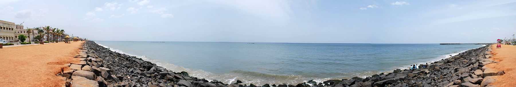
The most popular tourist destinations are the four beaches in Pondicherry, which are Promenade Beach (also known locally as the Rocky Beach), Beach, The Auroville Beach and Serenity Beach. Sri Aurobindo Ashram, located on rue de la Marine, is one of the most well known and wealthiest ashrams in India. Auroville (City of Dawn) is an "experimental" township located 8 km north-west of Pondicherry. It is meant to be a universal town where men and women of all countries are able to live in peace and progressive harmony, above all creeds, all politics and all nationalities.
There are a number of old and large churches in Pondicherry, most of which were built in the 18th and 19th centuries. A number of heritage buildings and monuments are present around the Promenade Beach, such as the Children's Park & Dupleix Statue, Gandhi statue, Nehru Statue, Le Café, French War Memorial, 19th Century Light House, Bharathi Park, Governors Palace, Romain Rolland Library, Legislative Assembly, Pondicherry Museum and the French Institute of Pondicherry at Saint-Louis Street.
Pudducherry Botanical Gardens is located south of the New Bus Stand. Chunnambar Backwater resort is situated 8 km from Pondicherry, along the Cuddalore Main Road. This tropical resort is flanked by a quiet-flowing creek on one side. Boating and tree house are very popular.
Arulmigu Manakula Vinayagar Devasthanam on Manakula Vinayagar Street is a famous Hindu temple, which houses Lord Ganesha. Sri Manakula Vinayagar Temple was in existence before the French came and settled in Pondicherry i.e. before 1666. According to Sasthra, Lord GANESHA is named in 16 types based on his various forms, out of which this god facing the east coast near the Bay of Bengal was named as Bhuvaneshar Ganapathy, now called as Manakula Vinayagar. In Tamil, 'Manal' means sand and 'Kulam' means pond near the sea. Earlier, there was full of sand around the pond. So, the people called the god as Manal Kulathu Vinayagar [means God near the pond of sand]. Later, it was named as Manakula Vinayagar.
Thirukaameeswarar Temple is one of the ancient temples located in a rural town called Villianur (the ancient name is Vilvanallur, meaning "vilva marangal niraindha nalla vur"), which is located about 10 km away (towards Villupuram) from Pondicherry town. This temple is renowned as Periya Koil "Big Temple". The prime god is Lord Shiva and the prime goddess is Goddess Kokilambigai. In addition, there are also other Hindu gods such as Murugan, Vinayagar, Thakshanamoorthy, Perumal, Bhramah, Chandikeshwarar, Natarajar, Navagrahah, and 63 Naayanmaars. The pioneers in this temple say that the age of this temple is about 1000+ years. It is thought to have been built by one of the Chola kings. There is also a huge "temple pond". The "Ther Thiruvizha" (Car Festival) is celebrated at this temple.
Institutions
- Dr. Ambedkar Govt. Law College, Periakalapet, Puducherry
- Mahatma Gandhi Medical College & Research Institute, Pillaiyarkuppam
- Pondicherry University, Kalapet
- Indira Gandhi Medical College & Research Institute (Govt. of Puducherry)
- Pondicherry Science Forum
- Pondicherry Institute of Medical Sciences, Kalapet
- Indira Gandhi College of Arts and Science
- College of Nursing, Pondicherry Institute of Medical Sciences, Kalapet
- Shri Krishnaa College of Engineering & Technology, Mannadipet, Thirukkanur
- RAAK Nursing College, Arumbharthapuram
- Tagore Arts College, Lawspet
- Kanchi Mamunivar Centre for Post-Graduate Studies, Lawspet
- Mahatma Gandhi post graduate institute for dental sciences
- Manakula Vinayagar Institute of Technology
- Jawaharlal Institute of Postgraduate Medical Education & Research
- Bharathidasan Government College for Women
- Mother Theresa Post-Graduate and Research Institute of Health Sciences
- Alpha College of Engineering & Technology
- Rajiv Gandhi Institute of Veterinary Education and Research
- Sri Ganesh College of Engineering & Technology
- Sri Manakula Vinayagar Engineering College
- Rajiv Gandhi College of Engineering and Technology
- Pondicherry Engineering College
- Perunthalaivar Kamarajar Institute of Engineering and Technology
- Achariya Arts & Science College
- Christ College of Engineering & Technology
- Saradha Gangadharan Arts & Science College
- Achariya College of Engineering & Technology
- Raak Engineering College, Arumbharthapuram
Notable people
Literature
- Tamil Poet Bharatidasan.
Spiritual
- Sri Aurobindo took part in the Indian independence movement.
- Mirra Alfassa
Actors, directors and performance artists
- M. Night Shyamalan, American film director, born in Mahe, Pondicherry
- Anandaraj, Tamil movie actor
- Kalki Koechlin, Bollywood actor
- Ayesha Kapur
Science and Technology
- S. Somasegar, Senior vice president, Microsoft
- Ganapathi Thanikaimoni, Indian scientist and director of the Palynology laboratory of the French Institute of Pondicherry
- Yvonne Artaud, French educationalist and psychologist.
- Navi Radjou, an innovation and leadership strategist based in Silicon Valley.[16]
Politicians and Public Servants
- V. Subbiah
- Edouard Goubert
- V. Venkatasubha Reddiar
- M. O. H. Farook
- V. Vaithilingam
- V. Narayanasamy
- N. Rangasamy
Armed Forces
- French General Jacques Lauriston was born in Pondicherry.
Fictional
- The titular character in Yann Martel's Life of Pi.
Gallery
-

Harbor at Pondicherry beach
-

Mahatma Gandhi's Statue
-
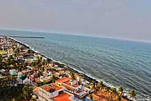
Pondicherry beach viewed from light house
-

French War Memorial
-

Park Monument (Aayi Mandapam) in the Government Park
-

Bharati Park (Government Park)
-

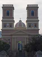
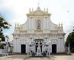
Basilica of the Sacred Heart of Jesus, Pondicherry
-
The Church of Our Lady of Angels
-

Soldier on guard at gate of Government Palace, Pondicherry
-

Goubert Avenue, Pondicherry, India
-

Street sign in Tamil and French
-

Puducherry Tamil house
-

French Consulate

See also
- Mahé, India
- Jawaharlal Institute of Postgraduate Medical Education & Research
- Mahatma Gandhi Medical College & Research Institute
- Pondicherry Engineering College
- Pondicherry University
- Rajiv Gandhi College of Veterinary and Animal Sciences
References
- ↑ http://www.pondicherryonline.in/Profile/Geography/
- ↑ Town and Country Planning Department, Pondicherry, India: City Development Plan – Pondicherry, Final Report, March 2007, S. 159
- ↑ "ETA-Fujitsu venture launches General ACs". Chennai. The Hindu Business Line. 19 September 2000. Retrieved 2012-09-16.
- ↑ "Smart grid project inaugurated". Puducherry. The Hindu. 2012-10-20. Retrieved 2012-10-23.
- ↑ "Climate: Pondicherry - Climate graph, Temperature graph, Climate table". Climate-Data.org. Retrieved 6 October 2013.
- ↑ http://education.vsnl.com/imdchennai/rdwr.htm
- ↑ "Pondicherry Climatological Table Period: 1971–2000". India Meteorological Department. Retrieved 11 April 2015.
- ↑ "Ever recorded Maximum and minimum temperatures up to 2010" (PDF). India Meteorological Department. Retrieved 11 April 2015.
- ↑ "Census of India 2001: Data from the 2001 Census, including cities, villages and towns (Provisional)". Census Commission of India. Archived from the original on 2004-06-16. Retrieved 2008-11-01.
- ↑ "Pondicherry: Forever France? by Anand Jha". Boloji.com. 2002-11-10. Retrieved 2013-03-18.
- ↑ Ramakrishnan, Deepa (23 February 2012). "After a decade on fast lane, ECR is set to expand". Chennai. The Hindu. Retrieved 2012-09-16.
- ↑ "20 buses launched in urban routes". Puducherry. The Hindu. 8 June 2010. Retrieved 2012-09-19.
- ↑ V, Venkatasubramanian (19 Feb 2010). "A boon to Kancheepuram unit of TNSTC". Kancheepuram. The Hindu. Retrieved 2012-09-15.
- ↑ "Delhi-Puducherry train link from July 3". The Hindu. 25 June 2011. Retrieved 2012-09-16.
- ↑ "Changes in train timings". Puducherry. The Hindu. 13 September 2012. Retrieved 2012-09-16.
- ↑ http://thinkbusiness.nus.edu/articles/item/126
External links
| Wikivoyage has a travel guide for Pondicherry. |
| Wikimedia Commons has media related to Puducherry. |
- (English) Official website of the Government of the Union Territory of Puducherry
- (English) Official website of Department of Tourism, Pondicherry
- (English) Official website for Tourism Development, Pondicherry
- (English) Pondicherry's City Portal & Guide
| ||||||||||||||||||||||||||||||||||||||