Polana, Laško
| Polana | |
|---|---|
_location_map.svg.png) Polana Location in Slovenia | |
| Coordinates: 46°4′50.44″N 15°17′44.97″E / 46.0806778°N 15.2958250°ECoordinates: 46°4′50.44″N 15°17′44.97″E / 46.0806778°N 15.2958250°E | |
| Country |
|
| Traditional region | Styria |
| Statistical region | Savinja |
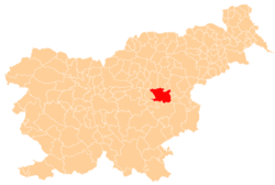
| Municipality | Laško |
| Area | |
| • Total | 7 km2 (3 sq mi) |
| Elevation | 499.7 m (1,639.4 ft) |
| Population (2002) | |
| • Total | 183 |
| [1] | |
Polana is a settlement in the hills east of Zidani Most in the Municipality of Laško in eastern Slovenia. The area was traditionally part of the Styria region. It is now included with the rest of the municipality in the Savinja statistical region.[2]
There are two churches near the settlement. Both belong to the Parish of Razbor. The church of Saint Cantius (Slovene: sveti Kancijan) lies northeast of the village. It dates to the mid-16th century with numerous 18th-century alterations. The church of Saint Josse (Slovene: sveti Jošt) is built on southern slopes just under the peak of Lisca Hill. It dates to the 17th century.[3]
References
- ↑ Statistical Office of the Republic of Slovenia
- ↑ Laško municipal site
- ↑ Slovenian Ministry of Culture register of national heritage reference numbers ešd 3310 & 3309