Pointe-à-la-Croix, Quebec
| Pointe-à-la-Croix | |
|---|---|
| Municipality | |
 | |
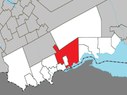 Location within Avignon RCM. | |
 Pointe-à-la-Croix Location in eastern Quebec. | |
| Coordinates: 48°01′N 66°41′W / 48.017°N 66.683°WCoordinates: 48°01′N 66°41′W / 48.017°N 66.683°W[1] | |
| Country |
|
| Province |
|
| Region |
Gaspésie– Îles-de-la-Madeleine |
| RCM | Avignon |
| Settled | 1750s |
| Constituted | May 7, 1983 |
| Government[2] | |
| • Mayor | Jean-Paul Audy |
| • Federal riding |
Gaspésie— Îles-de-la-Madeleine |
| • Prov. riding | Bonaventure |
| Area[2][3] | |
| • Total | 416.90 km2 (160.97 sq mi) |
| • Land | 394.39 km2 (152.27 sq mi) |
| Population (2011)[3] | |
| • Total | 1,472 |
| • Density | 3.7/km2 (10/sq mi) |
| • Pop 2006-2011 |
|
| • Dwellings | 725 |
| Time zone | EST (UTC−5) |
| • Summer (DST) | EDT (UTC−4) |
| Postal code(s) | G0C 1L0 |
| Area code(s) | 418 and 581 |
| Highways |
|
| Website |
www a-la-croix |
Pointe-à-la-Croix (Cross Point in English) is a municipality located on the Restigouche River in the Gaspésie region of eastern Quebec, Canada. It is situated across from the city of Campbellton, New Brunswick.
In addition to Pointe-à-la-Croix itself, the municipality also includes the communities of L'Alverne, Oak Bay, and Saint-Fidèle-de-Ristigouche.
The municipality is home to the site of the Battle of the Restigouche, a National Historic Site of Canada, and the Petite Rochelle interpretive centre.
History
The first Euro-American settlement in the town was by Acadians fleeing the Expulsion in 1755. Retreating as far as possible up the Restigouche River, they were trapped by a huge British fleet in the Battle of Restigouche. Approximately 1500 Acadian and Métis took refuge here, with the local Mi'kmaq Native Americans. Their combined resistance was not able to prevent an English landing at their village, which they had named La Petite Rochelle, after the Seingeurie de La Petite Rochelle, situated at Point au Bourdon. The village was completely destroyed by fire on August 23, 1760. Further upriver near Listuguj, the Battle of the Restigouche ended with all the French ships and most of the Acadians' boats sunk, but the English were not successful in landing because of the number of muskets on shore. The Acadians had made their last stand here and survived. Their resistance was in effect a success.
After the conquest, Pointe-à-la-Croix was primarily a fishing, forestry, and farming community until the opening of the J. C. Van Horne Bridge to Campbellton in 1962. In 1969, the town was still incorporated as Cross Point, but changed to the French name in 1970. The town now is nearly fully integrated economically with the Campbellton area.
Demographics
Population
| |||||||||||||||||||
| Historical Census Data - Pointe-à-la-Croix, Quebec[6] | ||||||||||||||||||||||||||
|---|---|---|---|---|---|---|---|---|---|---|---|---|---|---|---|---|---|---|---|---|---|---|---|---|---|---|
|
|
| ||||||||||||||||||||||||
Language
Mother tongue:[7]
- English as first language: 10.8%
- French as first language: 86.3%
- English and French as first language: 0.6%
- Other as first language: 2.2%
See also
References
- ↑ Reference number 50083 of the Commission de toponymie du Québec (French)
- ↑ 2.0 2.1 "Pointe-à-la-Croix". Répertoire des municipalités (in French). Ministère des Affaires municipales, des Régions et de l'Occupation du territoire. Retrieved 2012-01-04.
- ↑ 3.0 3.1 3.2 "Pointe-à-la-Croix census profile". 2011 Census data. Statistics Canada. Retrieved 2012-01-04.
- ↑ "2006 Community Profiles". Canada 2006 Census. Statistics Canada. March 30, 2011. Retrieved 2012-01-04.
- ↑ "2001 Community Profiles". Canada 2001 Census. Statistics Canada. February 17, 2012. Retrieved 2012-01-04.
- ↑ Statistics Canada: 1996, 2001, 2006, 2011 census
- ↑ "Pointe-à-la-Croix community profile". 2006 Census data. Statistics Canada. Retrieved 2012-01-04.
- “A la recherche de La Petite-Rochelle: Memory and Identity in Restigouche”, Acadiensis, XXVIII, 2 (Spring 1999), pp. 3–40; article p4
External links
 |
Routhierville | Rivière-Nouvelle | | |
| St-André-de-Restigouche | |
Nouvelle Escuminac | ||
| ||||
| | ||||
| Ristigouche-Partie-Sud-Est, Listuguj | Restigouche River / |
Restigouche River / |
| ||||||||||||||||||||||