Pleasanton, Nebraska
| Pleasanton, Nebraska | |
|---|---|
| Village | |
|
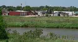
Pleasanton, looking northwest across the South Loup River | |
 Location of Pleasanton, Nebraska | |
| Coordinates: 40°58′7″N 99°5′17″W / 40.96861°N 99.08806°WCoordinates: 40°58′7″N 99°5′17″W / 40.96861°N 99.08806°W | |
| Country | United States |
| State | Nebraska |
| County | Buffalo |
| Area[1] | |
| • Total | 0.34 sq mi (0.88 km2) |
| • Land | 0.34 sq mi (0.88 km2) |
| • Water | 0 sq mi (0 km2) |
| Elevation | 2,083 ft (635 m) |
| Population (2010)[2] | |
| • Total | 341 |
| • Estimate (2012[3]) | 347 |
| • Density | 1,002.9/sq mi (387.2/km2) |
| Time zone | Central (CST) (UTC-6) |
| • Summer (DST) | CDT (UTC-5) |
| ZIP code | 68866 |
| Area code(s) | 308 |
| FIPS code | 31-39450[4] |
| GNIS feature ID | 0832267[5] |
Pleasanton is a village in Buffalo County, Nebraska, United States. The population was 341 at the 2010 census. Pleasanton was once the terminus of the Omaha and Republican Valley Railway, a Union Pacific line that ended in the 1940s.
History
Pleasanton was platted in 1890 when the railroad was extended to that point.[6] It was named from the Pleasant Valley on the Loup River, which was named for its scenic landscapes.[6] Pleasanton was incorporated as a village in 1894.[7][8]
Geography
Pleasanton is located at 40°58′7″N 99°5′17″W / 40.96861°N 99.08806°W (40.968612, -99.088086).[9]
According to the United States Census Bureau, the village has a total area of 0.34 square miles (0.88 km2), all of it land.[1]
Demographics
2010 census
As of the census[2] of 2010, there were 341 people, 140 households, and 93 families residing in the village. The population density was 1,002.9 inhabitants per square mile (387.2/km2). There were 151 housing units at an average density of 444.1 per square mile (171.5/km2). The racial makeup of the village was 99.7% White and 0.3% from two or more races. Hispanic or Latino of any race were 1.2% of the population.
There were 140 households of which 34.3% had children under the age of 18 living with them, 56.4% were married couples living together, 7.1% had a female householder with no husband present, 2.9% had a male householder with no wife present, and 33.6% were non-families. 30.0% of all households were made up of individuals and 16.5% had someone living alone who was 65 years of age or older. The average household size was 2.44 and the average family size was 3.05.
The median age in the village was 35.8 years. 28.2% of residents were under the age of 18; 8.1% were between the ages of 18 and 24; 23.8% were from 25 to 44; 23.5% were from 45 to 64; and 16.4% were 65 years of age or older. The gender makeup of the village was 48.1% male and 51.9% female.
2000 census
As of the census[4] of 2000, there were 360 people, 145 households, and 103 families residing in the village. The population density was 1,090.1 people per square mile (421.2/km²). There were 153 housing units at an average density of 463.3 per square mile (179.0/km²). The racial makeup of the village was 98.33% White, and 1.67% from two or more races. Hispanic or Latino of any race were 1.67% of the population.
There were 145 households out of which 35.2% had children under the age of 18 living with them, 61.4% were married couples living together, 6.9% had a female householder with no husband present, and 28.3% were non-families. 25.5% of all households were made up of individuals and 13.1% had someone living alone who was 65 years of age or older. The average household size was 2.48 and the average family size was 2.99.
In the village the population was spread out with 28.6% under the age of 18, 5.3% from 18 to 24, 28.3% from 25 to 44, 21.1% from 45 to 64, and 16.7% who were 65 years of age or older. The median age was 36 years. For every 100 females there were 98.9 males. For every 100 females age 18 and over, there were 97.7 males.
As of 2000 the median income for a household in the village was $37,656, and the median income for a family was $42,250. Males had a median income of $27,813 versus $21,389 for females. The per capita income for the village was $16,101. About 2.0% of families and 4.5% of the population were below the poverty line, including 5.3% of those under age 18 and 14.9% of those age 65 or over.
Notable natives
- Win Noyes, baseball player
References
- ↑ 1.0 1.1 "US Gazetteer files 2010". United States Census Bureau. Retrieved 2012-06-24.
- ↑ 2.0 2.1 "American FactFinder". United States Census Bureau. Retrieved 2012-06-24.
- ↑ "Population Estimates". United States Census Bureau. Retrieved 2013-05-29.
- ↑ 4.0 4.1 "American FactFinder". United States Census Bureau. Retrieved 2008-01-31.
- ↑ "US Board on Geographic Names". United States Geological Survey. 2007-10-25. Retrieved 2008-01-31.
- ↑ 6.0 6.1 Fitzpatrick, Lillian L. (1960). Nebraska Place-Names. University of Nebraska Press. p. 26.
- ↑ Bassett, Samuel Clay (1916). Buffalo County, Nebraska, and Its People: A Record of Settlement, Organization, Progress and Achievement, Volume 1. S.J. Clarke Publishing Company. p. 283.
- ↑ "Pleasanton, Buffalo County". Center for Advanced Land Management Information Technologies. University of Nebraska. Retrieved 30 July 2014.
- ↑ "US Gazetteer files: 2010, 2000, and 1990". United States Census Bureau. 2011-02-12. Retrieved 2011-04-23.
| |||||||||||||||||||||||||||||||||