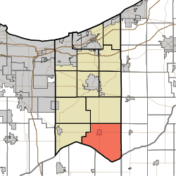
Pleasant Township, Porter County, Indiana
| Pleasant Township | |
|---|---|
| Township | |
|
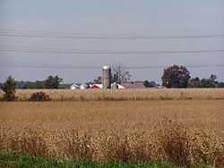
Corn and soybeans dominate Pleasant Township | |
 | |
| Coordinates: 41°17′46″N 86°59′40″W / 41.29611°N 86.99444°WCoordinates: 41°17′46″N 86°59′40″W / 41.29611°N 86.99444°W | |
| Country | United States |
| State | Indiana |
| County | Porter |
| Government | |
| • Type | Indiana township |
| Area | |
| • Total | 56.71 sq mi (146.88 km2) |
| • Land | 56.69 sq mi (146.83 km2) |
| • Water | 0.02 sq mi (0.04 km2) |
| Elevation[1] | 669 ft (204 m) |
| Population (2010) | |
| • Total | 4,432 |
| • Density | 78.2/sq mi (30.18/km2) |
| FIPS code | 18-60426[2] |
| GNIS feature ID | 453748 |
Pleasant Township is one of twelve townships in Porter County, Indiana. As of the 2010 census, its population was 4,432.[3]
Cities and towns
The township's only incorporated community is Kouts.[4]
Education
The township is served by the East Porter County School Corporation. Its high school is Kouts High School located in Kouts.
Cemeteries
| Name | Location | Picture | Ref pg[5] | Ref pg[6] |
|---|---|---|---|---|
| Graceland Cemetery | State Route 8, just west of Kouts | pg 54 | back | |
| Hopewell Cemetery | South Baums Bridge Road, just before SR 8 | back | ||
| St. Paul's Lutheran Cemetery | State Route 8, just west of Kouts | |||
| St. Mary's Catholic Cemetery | State Route 8, just west of Kouts | 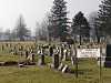 |
||
| Spencer Cemetery | South Baums Bridge Road, just before SR 8 | 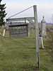 |
pg 54 | |
References
- ↑ "US Board on Geographic Names". United States Geological Survey. 2007-10-25. Retrieved 2008-01-31.
- ↑ "American FactFinder". United States Census Bureau. Retrieved 2008-01-31.
- ↑ "Geographic Identifiers: 2010 Demographic Profile Data (DP-1): Pleasant township, Porter County, Indiana". U.S. Census Bureau, American Factfinder. Retrieved March 22, 2013.
- ↑ Porter County, Indiana Sesquicentennial, 150, 1836-1986
- ↑ Soil Survey of Porter County, Indiana; USDA, Soil Conservation Service, Purdue University Agricultural Experiment Station, Indiana Department of natural Resources, Soil and Water Conservation Committee; February 1981
- ↑ Rand MacNally, Porter County, Indiana, 2001
_Porter_County_Indiana8.jpg)
Reeves ditch draining much of Pleasant Township
External links
| |||||||||||||||||||||||||||||||||