Piz Saluver
| Piz Saluver | |
|---|---|
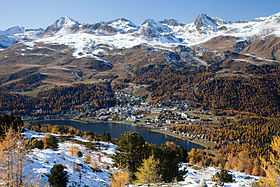 View from Muottas da Schlarigna with Piz Nair (left) and Piz Saluver (right) | |
| Elevation | 3,161 m (10,371 ft) |
| Prominence | 226 m (741 ft)[1] |
| Parent peak | Piz Ot |
| Location | |
 Piz Saluver Location in Switzerland | |
| Location | Graubünden, Switzerland |
| Range | Albula Alps |
| Coordinates | 46°31′50″N 9°47′44″E / 46.53056°N 9.79556°ECoordinates: 46°31′50″N 9°47′44″E / 46.53056°N 9.79556°E |
Piz Saluver (3,161 m) is a mountain of the Albula Alps, located west of Celerina in the canton of Graubünden. It lies between the Val Bever and the Val Saluver, both part of the Engadin.
References
- ↑ Retrieved from the Swisstopo topographic maps and Google Earth. The key col is located north-east of the summit at 2,935 metres.