Pirwani
For the mountain in the Potosí Department, Bolivia, see Pirwani (Bolivia). For the mountain in the Cusco Region, Peru, see Pirwani (Cusco).
| Pirwani | |
|---|---|
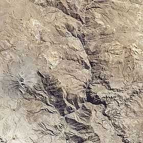 Satellite image of the volcano Ubinas (on the left), P'aqu Urqu (the light-colored complex north-east of it) and Pirwani (north of P'aqu Urqu) | |
| Elevation | 4,994 m (16,385 ft)[1] |
| Location | |
 Pirwani Peru | |
| Location | Peru, Moquegua Region, General Sánchez Cerro Province |
| Range | Andes |
| Coordinates | 16°15′35″S 70°49′25″W / 16.25972°S 70.82361°WCoordinates: 16°15′35″S 70°49′25″W / 16.25972°S 70.82361°W |
Pirwani (Aymara pirwa, piwra granary,[2][3] -ni a suffix to indicate ownership, "the one with a granary", hispanicized spelling Pirhuane) is a 4,994-metre (16,385 ft) high mountain in the Moquegua Region in the Andes of Peru. It is situated in the General Sánchez Cerro Province, Ubinas District. Pirwani is situated northeast of the active volcano Ubinas.[4] Like the mountains south of Pirwani, P'aqu Urqu and Wit'uni, Pirwani lies on the eastern border of the buffer zone of the Salinas and Aguada Blanca National Reservation.[1]
References
- ↑ 1.0 1.1 Valoración del Servicio Ambiental de Provisión de Agua con Base en la Reserva Nacional Salinas y Aguada Blanca - Cuenca del Río Chili, PROFONANPE, Lima, 2007
- ↑ Ministerio de Educación, Dirección National de Educación Bilingue Intercultural, Yatiqirinaka Aru Pirwa, Lima, 2005 (Aymara-Spanish dictionary)
- ↑ Radio San Gabriel, "Instituto Radiofonico de Promoción Aymara" (IRPA) 1993, Republicado por Instituto de las Lenguas y Literaturas Andinas-Amazónicas (ILLLA-A) 2011, Transcripción del Vocabulario de la Lengua Aymara, P. Ludovico Bertonio 1612 (Spanish-Aymara-Aymara-Spanish dictionary)
- ↑ escale.minedu.gob.pe - UGEL map of the General Sánchez Cerro Province (Arequipa Region)