Piqua, Kansas
| Piqua, Kansas | |
|---|---|
| Census-designated place | |
 Piqua, Kansas | |
| Coordinates: 37°55′22″N 95°32′07″W / 37.92278°N 95.53528°WCoordinates: 37°55′22″N 95°32′07″W / 37.92278°N 95.53528°W | |
| Country | United States |
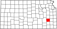
| State | Kansas |
| County | Woodson |
| Area[1] | |
| • Total | 4.007 sq mi (10.38 km2) |
| • Land | 3.968 sq mi (10.28 km2) |
| • Water | 0.039 sq mi (0.10 km2) |
| Elevation | 1,027 ft (313 m) |
| Population (2010)[2] | |
| • Total | 107 |
| • Density | 27/sq mi (10/km2) |
| Time zone | Central (CST) (UTC-6) |
| • Summer (DST) | CDT (UTC-5) |
| Area code(s) | 620 |
| GNIS feature ID | 474484[3] |
Piqua is an unincorporated community and census-designated place in Woodson County, Kansas, United States.[3] Its population was 107 as of the 2010 census.[2]
History
Piqua had its start in the year 1882 by the building of the railroad through that territory.[4] It was named after the city of Piqua, Ohio.[5]
The first post office in Piqua was established in March 1882.[6]
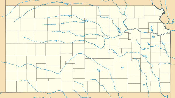
Geography
Latitude of Piqua is 37.922N and longitude is -95.535W. Piqua is located on U.S. Route 54 and is east of U.S. Route 75.[7]
Area attractions
Notable people
- Buster Keaton (1895–1966), acclaimed actor and film director. He was born in Piqua while his mother was traveling.
- Fred Kipp, Major league baseball pitcher between 1957-1960 with the Dodgers and Yankees.
References
- ↑ "US Gazetteer files: 2010, 2000, and 1990". United States Census Bureau. 2011-02-12. Retrieved 2011-04-23.
- ↑ 2.0 2.1 "American FactFinder". United States Census Bureau. Retrieved 2011-05-14.
- ↑ 3.0 3.1 "Piqua, Kansas". Geographic Names Information System. United States Geological Survey.
- ↑ Blackmar, Frank Wilson (1912). Kansas: A Cyclopedia of State History, Volume 2. Standard Publishing Company. p. 479.
- ↑ "Profile for Piqua, Kansas". ePodunk. Retrieved 28 June 2014.
- ↑ "Kansas Post Offices, 1828-1961". Kansas Historical Society. Retrieved 27 June 2014.
- ↑ Rand McNally, The Road Atlas '05, Skokie: Rand McNally & Company, 2005.
External links
| |||||||||||||||||||||