Piney, Oklahoma
| Piney, Oklahoma | |
|---|---|
| Census-designated place | |
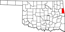
 Location within Adair County and the state of Oklahoma | |
| Coordinates: 35°53′4″N 94°32′29″W / 35.88444°N 94.54139°WCoordinates: 35°53′4″N 94°32′29″W / 35.88444°N 94.54139°W | |
| Country | United States |
| State | Oklahoma |
| County | Adair |
| Area | |
| • Total | 4.6 sq mi (11.9 km2) |
| • Land | 4.5 sq mi (11.7 km2) |
| • Water | 0.08 sq mi (0.2 km2) |
| Elevation | 1,160 ft (350 m) |
| Population (2010) | |
| • Total | 115 |
| • Density | 25/sq mi (9.8/km2) |
| Time zone | Central (CST) (UTC-6) |
| • Summer (DST) | CDT (UTC-5) |
| FIPS code | 40-59100[1] |
| GNIS feature ID | 2584389[2] |
Piney is a census-designated place (CDP) in Adair County, Oklahoma, United States. The population was 115 at the 2010 census.[3]
The original settlement of Piney is now considered a ghost town. It was established in 1824 and served as the capital of the Cherokee Nation from 1824 to 1828, when the town was part of what was then Arkansas Territory.[4]
The town reached its largest size about 1916. It had a general store, where the post office was located; a gristmill; a blacksmith's shop; and a school, which is now used as a community building. Some residents still live in the area.[4]
A Baptist missionary, Duncan O'Bryant, came to Piney. He died in 1834 and his grave is in Piney.[4]
Piney had a post office from November 24, 1913, to August 20, 1921. In 1828, the borders of the state of Arkansas were drawn, so the Cherokee Nation capital was moved to Tahlonteeskee, and most of the Cherokee residents migrated to the Indian Territory. The town, however, continued until 1940.[4]
Geography
Piney is located at 35°53′4″N 94°32′29″W / 35.88444°N 94.54139°W in eastern Adair County, 1 mile (2 km) west of the Arkansas border. No major roads run through the community.
According to the United States Census Bureau, the CDP has a total area of 4.6 square miles (11.9 km2), of which 4.5 square miles (11.7 km2) is land and 0.077 square miles (0.2 km2), or 1.32%, is water.[3]
See also
References
- ↑ "American FactFinder". United States Census Bureau. Retrieved 2008-01-31.
- ↑ "US Board on Geographic Names". United States Geological Survey. 2007-10-25. Retrieved 2008-01-31.
- ↑ 3.0 3.1 "Geographic Identifiers: 2010 Demographic Profile Data (G001): Piney CDP, Oklahoma". U.S. Census Bureau, American Factfinder. Retrieved July 12, 2013.
- ↑ 4.0 4.1 4.2 4.3 Morris 151
- Morris John Wesley. Ghost Towns of Oklahoma. Norman: University of Oklahoma Press, 1978. ISBN 978-0-8061-1420-0.
| |||||||||||||||||||||||||