Piney, Manitoba

Piney
Location of Piney in Manitoba
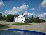
Piney is a community in southeastern Manitoba in the Rural Municipality of Piney. It is approximately 130 kilometers from Winnipeg and within five kilometres of the American border.
It is served by the Piney Pinecreek Border Airport, unusual in that its runway lies across the international border.
Climate
| Climate data for Piney | |||||||||||||
|---|---|---|---|---|---|---|---|---|---|---|---|---|---|
| Month | Jan | Feb | Mar | Apr | May | Jun | Jul | Aug | Sep | Oct | Nov | Dec | Year |
| Record high °C (°F) | 7 (45) |
11.5 (52.7) |
18 (64) |
31 (88) |
33 (91) |
35 (95) |
38 (100) |
36.5 (97.7) |
35 (95) |
29 (84) |
19 (66) |
9.5 (49.1) |
38 (100) |
| Average high °C (°F) | −10.7 (12.7) |
−6.2 (20.8) |
−0.9 (30.4) |
10.9 (51.6) |
18.9 (66) |
22.8 (73) |
25.3 (77.5) |
24.9 (76.8) |
18.5 (65.3) |
10.7 (51.3) |
−0.3 (31.5) |
−8.6 (16.5) |
8.9 (48) |
| Daily mean °C (°F) | −16.4 (2.5) |
−12 (10) |
−4.6 (23.7) |
4.3 (39.7) |
11.7 (53.1) |
16.3 (61.3) |
18.8 (65.8) |
18 (64) |
12.1 (53.8) |
5.1 (41.2) |
−4.4 (24.1) |
−13.5 (7.7) |
3 (37) |
| Average low °C (°F) | −22.1 (−7.8) |
−17.6 (0.3) |
−10 (14) |
−2.3 (27.9) |
4.3 (39.7) |
9.9 (49.8) |
12.3 (54.1) |
11 (52) |
5.6 (42.1) |
−0.4 (31.3) |
−8.6 (16.5) |
−18.4 (−1.1) |
−3 (27) |
| Record low °C (°F) | −46 (−51) |
−48.5 (−55.3) |
−38.5 (−37.3) |
−22 (−8) |
−9 (16) |
−3 (27) |
1.5 (34.7) |
−3 (27) |
−9 (16) |
−20 (−4) |
−40.5 (−40.9) |
−43.5 (−46.3) |
−48.5 (−55.3) |
| Average precipitation mm (inches) | 25.2 (0.992) |
20.6 (0.811) |
23.1 (0.909) |
29.1 (1.146) |
64.8 (2.551) |
105.2 (4.142) |
89 (3.5) |
76.9 (3.028) |
62.3 (2.453) |
51.6 (2.031) |
31.1 (1.224) |
24.9 (0.98) |
603.8 (23.772) |
| Source: Environment Canada[1] | |||||||||||||
Gallery
-

Piney Municipal Office
-

Piney CN station, 1979
-

View of Piney looking north, 2007
-

Piney Hotel, 2007
References
- ↑ "Canadian Climate Normals 1971–2000". Environment Canada. Retrieved 25 Augaust 2012. Check date values in:
|accessdate=(help)
Coordinates: 49°04′31″N 95°58′42″W / 49.07528°N 95.97833°W