Pilsley, North East Derbyshire
| Pilsley | |
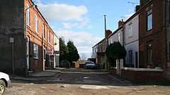 New Street, Pilsley |
|
 Pilsley |
|
| OS grid reference | SK424621 |
|---|---|
| District | North East Derbyshire |
| Shire county | Derbyshire |
| Region | East Midlands |
| Country | England |
| Sovereign state | United Kingdom |
| Post town | CHESTERFIELD |
| Postcode district | S45 |
| Police | Derbyshire |
| Fire | Derbyshire |
| Ambulance | East Midlands |
| EU Parliament | East Midlands |
|
|
Coordinates: 53°09′18″N 1°21′58″W / 53.155°N 1.366°W
Pilsley is a rural village in Northeast Derbyshire, near Chesterfield. Pilsley consists of two distinct residential areas known as Lower Pilsley and Pilsley (sometimes Upper Pilsley). Lower Pilsley being the northern residential area and Pilsley being the southern residential area. There is some local disagreement as to whether these two areas constitute two separate villages or one larger village. Both areas of the village are united by the same parish council, Pilsley Parish Council, which was formed on 30 January 1874; Pilsley having previously been part of the parish of North Wingfield.[1] Maps show that the village is made up of four separate residential areas, which are, in order of their north to south alignment, Lower Pilsley, Upper Pilsley, Pilsley and Nether Pilsley.[2]
Pilsley has an Anglican church, St. Mary's, an evangelical Methodist church, two primary schools, a post office and a Kingdom Hall building for Jehovah's Witnesses. Pilsley also has a Village Hall and St Mary's Centre (formerly the church hall). Recently a new sports centre (The Elm Centre) was built for the school which is also available for community use. A section of the Midland Main Line (Nottingham to Chesterfield section) runs along the western edge of the village. A branch of the Great Central Railway ran through the village prior to the Beeching cuts of the 1960s, with a station sited on Station Road. The route of this former railway line now serves as a popular walking, cycling and horse riding trail known as the Five Pits Trail, linking Pilsley to Tibshelf, Holmewood, Grassmoor and beyond.
Pilsley has a Sunday league football team called Pilsley Miners Welfare Football Club. The team is currently part of the Chesterfield and District Sunday League.[3]
The source of the River Rother is at Pilsley.
History
Pilsley is mentioned in the Domesday Book as one of the manors belonging to Walter D'Aincourt.[4]
Prior to 1800, Pilsley was an agricultural settlement and consisted of Upper Pilsley and Nether Pilsley. Few of the houses from that period still exist, these being some of on the corner of Station Road and Sitwell Grange Lane near the Primary School; others around Barlow Bank, Barlow Bank Farm and Grange Farm in Upper Pilsley near the site of the village well. These houses are made from locally quarried coal-measure sandstone which is soft and contains a high percentage of iron. This quarry no longer exists, but was north of Upper Pilsley.
Pilsley Colliery was founded in 1866 on the site of the present day Locko Plantation. At its peak the colliery comprised six shafts, employed 945 men and produced 1,200 tons of coal per shift. The colliery was closed in 1957.[5]
References
- ↑ Kelly's Directory of the Counties of Derby, Notts, Leicester and Rutland, pub. London (May, 1891) - p.284, accessed May 2013
- ↑ Explorer 269, Chesterfield and Alfreton 1:25000 scale, Ordnance Survey, 1999, ISBN0-319-21905-4
- ↑ Pilsley Miners Welfare Football Club Website
- ↑ Domesday Book: A Complete Translation. London: Penguin, 2003. p.750 ISBN 0-14-143994-7
- ↑ A.N. Bridgewater, 2001. Pilsley Colliery
External links
![]() Media related to Pilsley, North East Derbyshire at Wikimedia Commons
Media related to Pilsley, North East Derbyshire at Wikimedia Commons