Pieterburen
| Pieterburen | |
|---|---|
| Village | |
|
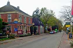
Hoofdstraat, Pieterburen, at the left the café Het wapen van Hunsingo (nowadays Bij de buren van Pieter) | |
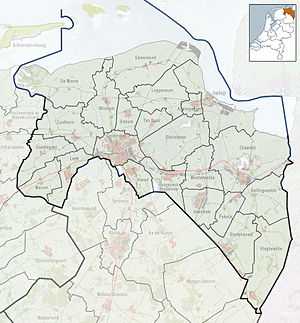 Pieterburen Location of Pieterburen in the province of Groningen | |
| Coordinates: 53°24′00″N 6°27′10″E / 53.40000°N 6.45278°ECoordinates: 53°24′00″N 6°27′10″E / 53.40000°N 6.45278°E | |
| Country | Netherlands |
| Province | Groningen |
| Municipality | De Marne |
| Population (1 January 2008) | |
| • Total | 379 |
| Time zone | CET (UTC+1) |
| • Summer (DST) | CEST (UTC+2) |
Pieterburen is a village in the municipality of De Marne in the northern part of the province of Groningen in the Netherlands.
Pieterburen is situated on the ‘Hogeland’ (high land) of Groningen. It is an area with brick Gothic churches, stately farms, and endless views over the land, all the way to the Wadden Sea.
Pieterburen is known for its Seal Rehabilitation and Research Centre, the vicarage garden Domiestoen, the old mill De Vier Winden (Literally translated: The Four Winds), and for mudflat hiking in the Wadden Sea. Regrettably, the medieval castle Huis ten Dyke was torn down a century ago. Pieterburen is also the start of the Pieterpad, a long-distance hiking trail to Sint Pieter in the extreme south of the Netherlands
-
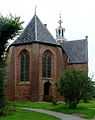
The church
-

Wind mill De Vier Winden
-
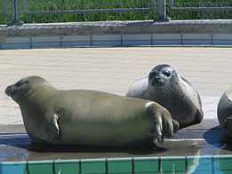
Seals in the rehabilitation center
References
External links
-
 Media related to Pieterburen at Wikimedia Commons
 -
 Pieterburen travel guide from Wikivoyage