Pico Humboldt
This article is about the Venezuelan Peak. For the Colorado fourteener, see Humboldt Peak (Colorado).
| Pico Humboldt | |
|---|---|
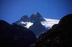 Pico Humboldt as seen from the Coromoto-La Verde trail. | |
| Elevation | 4,940 m (16,210 ft) |
| Location | |
| Location | Mérida, Venezuela |
| Range | Sierra Nevada, Andes |
| Coordinates | 8°32′58.78″N 70°59′46.11″W / 8.5496611°N 70.9961417°WCoordinates: 8°32′58.78″N 70°59′46.11″W / 8.5496611°N 70.9961417°W |
| Climbing | |
| First ascent | 1911 by Alfredo Jahn |
| Easiest route | Laguna del Suero |
Pico Humboldt is Venezuela's second highest peak, at 4,940 metres above sea level. It is located in the Sierra Nevada de Merida, in the Venezuelan Andes of (Mérida State). The peak with its sister peak Pico Bonpland, and the surrounding páramos are protected by the Sierra Nevada National Park.
It is named after the famous German explorer and naturalist Alexander von Humboldt.
Glaciers
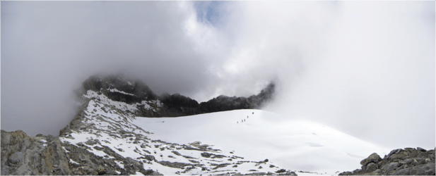
The summit is surrounded by the Eastern Coromoto glacier and the Sievers glacier, the two largest out of the four glaciers remaining in the country (the other two smaller glaciers are on Pico Bolívar). The glaciers on Humboldt Peak (as most tropical glaciers) have been receding fast since the 1970s and they are forecast to melt completely in a couple of decades.
References
| Wikimedia Commons has media related to Humboldt Peak (Venezuela). |
- Jahn A, Observaciones glaciológicas de los Andes venezolanos. Cult. Venez. 1925, 64:265-80