Pickrelltown, Ohio
| Pickrelltown, Ohio | |
|---|---|
| Unincorporated community | |
|
Aerial view of Pickrelltown from the east | |
 Location of Pickrelltown, Ohio | |
| Coordinates: 40°17′59″N 83°39′37″W / 40.29972°N 83.66028°WCoordinates: 40°17′59″N 83°39′37″W / 40.29972°N 83.66028°W | |
| Country | United States |
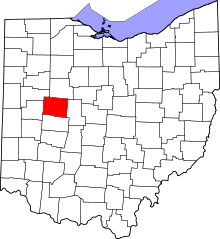
| State | Ohio |
| County | Logan |
| Time zone | Eastern (EST) (UTC-5) |
| • Summer (DST) | EDT (UTC-4) |
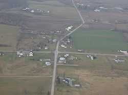
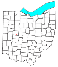
Pickrelltown is an unincorporated community located at the intersection of two roads (County Roads 28 and 29) in northern Monroe Township, Logan County, Ohio, United States. It has also been known as Frogtown, and its current name has also been spelled Pickereltown, Pickeretown, and Pickreltown.[1] The community consists of a few homes and a small church, plus a historic monument (a memorial to dead soldiers from the community) placed in the middle of the intersection. The monument was destroyed in April 2000[2] and again in April 2014, and was replaced each time.
Geography
Pickrelltown lies at an elevation of 1,411 feet (430 m) and is located at 40°17′59″N 83°39′37″W / 40.29972°N 83.66028°W (40.2997777, -83.6602083),[1] a short distance south of Mad River Mountain Ski Resort and southeast of Bellefontaine. The headwaters of the Macochee Creek, a small stream that meets the Mad River at West Liberty, are located around Pickrelltown.[3]
Pigeon Town, a town of the Shawnee Mekoche division, was located on Mad River, 3 miles northwest of West Liberty, Logan County, Ohio.[4]
Notable natives
- Solomon L. Hoge — South Carolina Supreme Court justice and U.S. representative from South Carolina
References
- ↑ 1.0 1.1 U.S. Geological Survey Geographic Names Information System: Pickrelltown, Ohio, Geographic Names Information System, 1979-07-12. Accessed 2008-01-10.
- ↑ Monument Destroyed, Bellefontaine Examiner, 2000-04-20. Accessed 2008-01-10.
- ↑ DeLorme. Ohio Atlas & Gazetteer. 7th ed. Yarmouth: DeLorme, 2004, p. 56. ISBN 0-89933-281-1.
- ↑ "Shawnee Indian Tribe History". Access Genealogy. Retrieved 2013-02-18.
External links
| |||||||||||||||||||||||||||||||||