Pickens County, Alabama
| Pickens County, Alabama | |
|---|---|
 Pickens County Courthouse in Carrollton | |
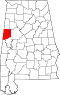 Location in the state of Alabama | |
 Alabama's location in the U.S. | |
| Founded | December 20, 1820 |
| Named for | Andrew Pickens |
| Seat | Carrollton |
| Largest city | Aliceville |
| Area | |
| • Total | 890 sq mi (2,305 km2) |
| • Land | 881 sq mi (2,282 km2) |
| • Water | 8.7 sq mi (23 km2), (1.0%) |
| Population | |
| • (2010) | 19,746 |
| • Density | 22/sq mi (8/km²) |
| Congressional district | 7th |
| Time zone | Central: UTC-6/-5 |
| Website |
www |
Pickens County is a county of the U.S. state of Alabama. As of the 2010 census, the population was 19,746.[1] Its county seat is Carrollton.[2] It is a prohibition, or dry county, although the communities of Carrollton and Aliceville voted to become wet in 2011 and 2012, respectively.
Pickens County is included in the Tuscaloosa, AL Metropolitan Statistical Area
History
Pickens County was established on December 20, 1820, and named for revolutionary war hero General Andrew Pickens of South Carolina. The county seat was relocated from Pickensville to Carrollton in 1830. The first courthouse in Carrollton was burned on April 5, 1865, by troops of Union General John T. Croxton. A second courthouse was also destroyed by fire on November 16, 1876. Though arson was suspected, no arrest was made until January 1878, when Henry Wells, an African American with some criminal history was arrested and locked in the garett of the new building, which had been erected in 1877. According to legend, Wells was peering down from the north garett window as a mob gathered to hang him. A bolt of lightning struck nearby and "etched" Wells' anguished face into the window glass. A vague image resembling a face can still be seen in that lower right-hand pane of that window. Also see: Pickens County Courthouse.
On April 8, 1998, a supercell thunderstorm produced an F3 tornado in Pickens County. This windstorm injured two people and damaged five homes including mobile homes. It rotated seventeen miles (27 km) from Holman to north of Northport. Twenty-four homes and thirteen mobile homes were also in destruction. Moments later, that same supercell thunderstorm produced an F5 tornado that struck northeastern Tuscaloosa near the Black Warrior River before entering western Jefferson County where it destroyed Oak Grove High School and killed thirty-two people in its path.
Geography
According to the U.S. Census Bureau, the county has a total area of 890 square miles (2,300 km2), of which 881 square miles (2,280 km2) is land and 8.7 square miles (23 km2) (1.0%) is water.[3]
Adjacent counties
- Lamar County (north)
- Fayette County (northeast)
- Tuscaloosa County (east)
- Greene County (southeast)
- Sumter County (south)
- Noxubee County, Mississippi (southwest)
- Lowndes County, Mississippi (west)
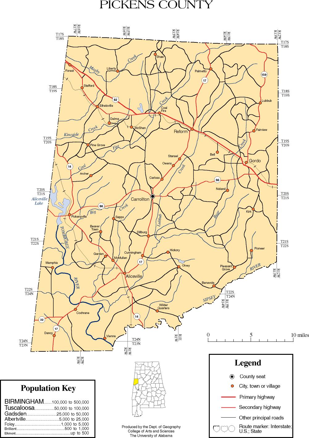
Transportation
Major highways
 U.S. Highway 82
 State Route 14
 State Route 17
 State Route 32
 State Route 86
 State Route 159
Rail
Demographics
| Historical population | |||
|---|---|---|---|
| Census | Pop. | %± | |
| 1830 | 6,622 | — | |
| 1840 | 17,118 | 158.5% | |
| 1850 | 21,512 | 25.7% | |
| 1860 | 22,316 | 3.7% | |
| 1870 | 17,690 | −20.7% | |
| 1880 | 21,479 | 21.4% | |
| 1890 | 22,470 | 4.6% | |
| 1900 | 24,402 | 8.6% | |
| 1910 | 25,055 | 2.7% | |
| 1920 | 25,353 | 1.2% | |
| 1930 | 24,902 | −1.8% | |
| 1940 | 27,671 | 11.1% | |
| 1950 | 24,349 | −12.0% | |
| 1960 | 21,882 | −10.1% | |
| 1970 | 20,326 | −7.1% | |
| 1980 | 21,481 | 5.7% | |
| 1990 | 20,699 | −3.6% | |
| 2000 | 20,949 | 1.2% | |
| 2010 | 19,746 | −5.7% | |
| Est. 2013 | 19,401 | −1.7% | |
| U.S. Decennial Census[4] 1790-1960[5] 1900-1990[6] 1990-2000[7] 2010-2013[1] | |||
As of the 2010 United States Census, there were 19,746 people in the county. 56.3% were White, 41.6% Black or African American, 0.2% Asian, 0.1% Native American, 0.6% of some other race and 1.2% of two or more races. 1.6% were Hispanic or Latino (of any race).
As of the census[8] of 2000, there were 20,949 people, 8,086 households, and 5,789 families residing in the county. The population density was 24 people per square mile (9/km2). There were 9,520 housing units at an average density of 11 per square mile (4/km2). The racial makeup of the county was 55.95% White, 42.96% Black or African American, 0.12% Native American, 0.11% Asian, 0.02% Pacific Islander, 0.22% from other races, and 0.63% from two or more races. About 0.70% of the population were Hispanic or Latino.
There were 8,086 households, out of which 32.60% had children under the age of 18 living with them, 49.80% were married couples living together, 18.20% had a female householder with no husband present, and 28.40% were non-families. Nearly 26.40% of all households were made up of individuals, and 12.50% had someone living alone who was 65 years of age or older. The average household size was 2.56, and the average family size was 3.11.
In the county, the population was spread out with 27.30% under the age of 18, 8.50% from 18 to 24, 25.80% from 25 to 44, 22.80% from 45 to 64, and 15.70% who were 65 years of age or older. The median age was 37 years. For every 100 females, there were 88.10 males. For every 100 females age 18 and over, there were 83.30 males.
The median income for a household in the county was $26,254, and the median income for a family was $32,938. Males had a median income of $28,843 versus $20,569 for females. The per capita income for the county was $13,746. About 20.10% of families and 24.90% of the population were below the poverty line, including 34.30% of those under age 18 and 22.30% of those age 65 or over.
Communities
Cities
Towns
CDPs
Unincorporated communities
Places of interest
One of the most famous tourist attractions in Pickens County is located at the County Seat, Carrollton, AL. The town is home to several stately ante-bellum homes. As mentioned earlier in this article, the vintage courthouse sitting on the courthouse square has the haunting site of a man's face etched in an attic window during the late 1800's. People traveling through stop frequently to see the sight. Many plan their vacations and travels around this unusual sight.
In the southern part of the county, the Aliceville Museum and Cultural Center hosts art from local artisans and artifacts from the Aliceville WWII POW camp. Another site of interest in the Aliceville area is not, however, a popular tourist attraction is the recently opened Federal Women's Correctional facility. On the south side of the city is a small port on the Tennessee - Tombigbee Waterway used primarily for timber and agricultural products.
On the southwestern side of the county, Pickensville is the site of the Tom Bevill Lock and Dam and Museum. It is named after the late Congressman Tom Bevill who had represented the district to Washington and was a strong proponent of the building of the Tennessee - Tombigbee Waterway system.
The East-West northern transportation route is U.S. Hwy 82 that connects the two population centers of the region, Tuscaloosa, AL (Shelton State Community College and the University of Alabama) and Columbus, MS (Columbus Air Force Base and Mississippi University for Women). From East to West it crosses through the cities, towns and villages of Gordo, AL, Reform, AL, Coalfire, AL (unincorporated), McShan, AL (unincorporated), Ethelsville, AL and Forest, AL (unincorporated).
Gordo, AL hosts the Pickens County Genealogical Society in a restored two-story building that was once the jail for that area. Not far from the old-jail, is the new Ma'Cile's Museum of Miscellanea, successor to a home-grown rural museum about rural life operated by one lady and her family for many decades. Annually, the town celebrates its annual "Mule Day and Chicken Fest". The reference to mules is to pay homage to the farming that established and built the area. The reference to chickens gives honor to the current economic benefits that modern chicken production, headquartered in Gordo, provide to the region.
Just north of Reform, AL, along AL Hwy 17 is Shady Grove Cemetery on a hilltop over the highway. Though not large, it was one of the earliest cemeteries in the area. It was co-established with the construction of the Shady Grove Methodist Episcopal Church, South. The church itself closed long before 1900, but the historic cemetery remain. As with many of the older cemeteries in the area interments are visible of Civil War soldiers and individuals from before that time. Around the turn of the 19th into the 20th century, the church building was dismantled and sold. One nearby family, the McGahey's built a small bungalow style cottage from the materials they obtained. That home stands today. Amazing, in keeping with the history of the construction materials being from an old-fashioned Methodist Church, the current owner and occupant is an independent Methodist pastor. The home has been in his family for over a half-century.
Further north along AL Hwy 17 one passes through the Friendship Community and arrives at Palmetto. Once a thriving village with its own school, several stores, and a cotton gin; not much is left of the old days. However, the community is still thriving as a rural culture center with an active program of family spiritual activities. On the east side of AL Hwy 17 are signs pointing to the Unity Grove Campground. This is long-standing place where a central tabernacle stands surrounded by "tents", actually very simple camping cabins. Founded in the 1800's, it is owned and operated by a private non-denominational association of families and members. Every year at the end of summer, members and area visitors gather morning, noon and night for a week-long series of Christian evangelistic sermons and fellowship meetings.
Heading west from Reform is the McShan Community. On the north side of U.S. Hwy 82 is one of the largest private lake systems in the area known simply as "McShan Lake" and so named after its builder and current owners. Across from the lake's dam on a hillside overlooking the highway is a stately plantation reproduction home with well manicured lawns. It, too, was built by the McShan family, thus is known locally as "McShan Mansion." However, the builders and owners who made their fortunes in timber and sawmilling (their only current mill is a large modern operation immediately behind the home)named it "Melrose" after a similarly patterned estate in New Orleans, Louisiana.
See also
- National Register of Historic Places listings in Pickens County, Alabama
- Properties on the Alabama Register of Landmarks and Heritage in Pickens County, Alabama
Notes
- ↑ 1.0 1.1 "State & County QuickFacts". United States Census Bureau. Retrieved May 17, 2014.
- ↑ "Find a County". National Association of Counties. Retrieved 2011-06-07.
- ↑ "US Gazetteer files: 2010, 2000, and 1990". United States Census Bureau. 2011-02-12. Retrieved 2011-04-23.
- ↑ "U.S. Decennial Census". United States Census Bureau. Retrieved May 17, 2014.
- ↑ "Historical Census Browser". University of Virginia Library. Retrieved May 17, 2014.
- ↑ "Population of Counties by Decennial Census: 1900 to 1990". United States Census Bureau. Retrieved May 17, 2014.
- ↑ "Census 2000 PHC-T-4. Ranking Tables for Counties: 1990 and 2000" (PDF). United States Census Bureau. Retrieved May 17, 2014.
- ↑ "American FactFinder". United States Census Bureau. Retrieved 2011-05-14.
References
- Windham, Kathryn Tucker (1969). 13 Alabama Ghosts and Jeffrey. Strode. ISBN 0-87397-008-X..
External links
- Genealogical and Historical Web Site
- Pickens County map of roads/towns (map © 2007 Univ. of Alabama).
- Pickens County article, Encyclopedia of Alabama
 |
Lowndes County, Mississippi | Lamar County | Fayette County | |
| |
Tuscaloosa County | |||
| ||||
| | ||||
| Noxubee County, Mississippi | Sumter County | Greene County |
| |||||||||||||||||
| |||||||||||||||||||||||||
| ||||||||||||||||||||||||||||||||||
Coordinates: 33°16′43″N 88°05′35″W / 33.27861°N 88.09306°W