Pic de Sanfonts
| Pic de Sanfonts | |
|---|---|
 Pic de Sanfonts (left), Agulla de Baiau (right) and Estany Negre. | |
| Elevation | 2,894 m (9,495 ft) |
| Prominence | 150 m (490 ft) |
| Location | |
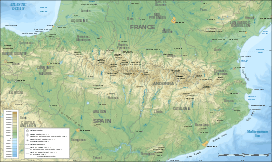 Pic de Sanfonts Location of Pic de Sanfonts in the Pyrenees | |
| Location | Andorra |
| Range | Pyrenees |
| Coordinates | 42°36′0″N 1°26′43″E / 42.60000°N 1.44528°ECoordinates: 42°36′0″N 1°26′43″E / 42.60000°N 1.44528°E |
Pic de Sanfonts (Catalan pronunciation: [ˈpiɡ də səmˈfɔns], locally: [ˈpiɡ de samˈfɔns]) is a mountain in the Pyrenees on the border of Spain and northwest Andorra. The nearest town is Arinsal, La Massana.[1] It is a subpeak of, and 1.2 km southwest of, Coma Pedrosa (2942 m), the highest mountain in Andorra.
References
- ↑ Parroquia de la Massana, Comú de la Massana. (Catalan)