Piangil
| Piangil Victoria | |||||||||||||
|---|---|---|---|---|---|---|---|---|---|---|---|---|---|
|
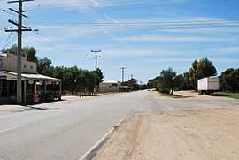
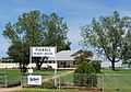
Murray St (Mallee Highway), the main street of Piangil | |||||||||||||
 Piangil | |||||||||||||
| Coordinates | 35°03′0″S 143°18′0″E / 35.05000°S 143.30000°ECoordinates: 35°03′0″S 143°18′0″E / 35.05000°S 143.30000°E | ||||||||||||
| Population | 333 (2011 census)[1] | ||||||||||||
| Postcode(s) | 3597 | ||||||||||||
| Location | |||||||||||||
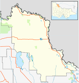
| LGA(s) | Rural City of Swan Hill | ||||||||||||
| State electorate(s) | Mildura | ||||||||||||
| Federal Division(s) | Mallee | ||||||||||||
| |||||||||||||
Piangil is a town in the Mallee region of northern Victoria Australia. It is approximately 382 kilometres (237 mi) north west of the state capital, Melbourne and 46 kilometres (29 mi) north west of the regional centre of Swan Hill. At the 2011 census, Piangil and the surrounding rural area had a population of 333.[1]
Piangil Post Office opened on 17 June 1907 and was renamed Piangil North in 1918 when Piangil was relocated adjacent to the railway station. A new Piangil Post Office opened in 1921 and is still in operation.[2]
Gallery
-
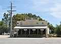
General store
-
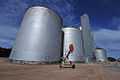
Grain storage
-
Primary school
-

Post office
-
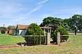
Former bowls club
References
- ↑ 1.0 1.1 Australian Bureau of Statistics (31 October 2012). "Piangil (State Suburb)". 2011 Census QuickStats. Retrieved 5 December 2014.
- ↑ Premier Postal History, Post Office List, retrieved 2008-04-11
External links
![]() Media related to Piangil, Victoria at Wikimedia Commons
Media related to Piangil, Victoria at Wikimedia Commons